Facebook Twitter Instagram YouTube

Written on: September 8th, 2021 in Living Shorelines, Wetland Restoration
By Joshua Moody, Partnership for the Delaware Estuary
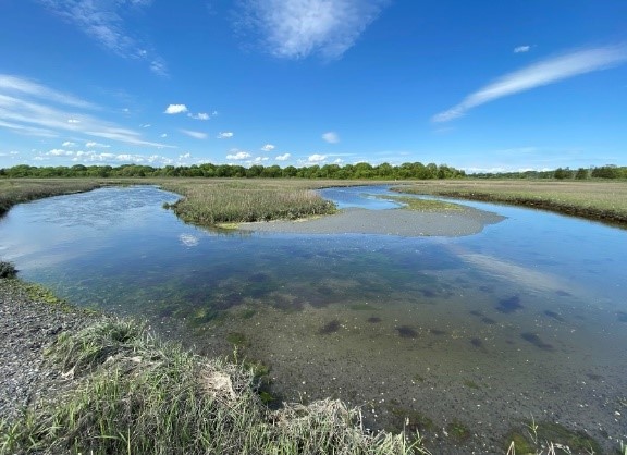
Since 2014, the City of Lewes, Delaware has been actively renovating the downtown waterfront park and shoreline along the Lewes-Rehoboth Canal, including native plant landscaping, playground features, walking paths, and educational signage. This work has been a part of a larger plan by the city to provide public open space, enhance tourism, and provide greater opportunity for public engagement. The little league baseball field located next to the Lightship Overfalls museum is a prominent feature of the public area along the canal, serving as a community gathering and recreational area. A narrow fringe of salt marsh separates the ballfields from the canal, helping to protect them from flooding by absorbing water. However, flood protection is not the only service that the salt marsh provides. The band of intertidal vegetation serves important roles for many fish, birds, and other animals that call Delaware home. Juvenile fish feed and take refuge from predators in the flooded vegetation and in the intertidal creeks, birds nest and forage for food among the grass and along the adjacent mud flat, and shellfish settle intertidally to filter food (and pollutants) from the water while simultaneously fertilizing plants and providing habitats for many smaller invertebrates. Additionally, when water floods the salt marsh, the plants can take up nitrogen and trap sediments that can have negative water quality impacts. The eroding salt marsh was not just bad for the ballfields, but for the local ecology as well.
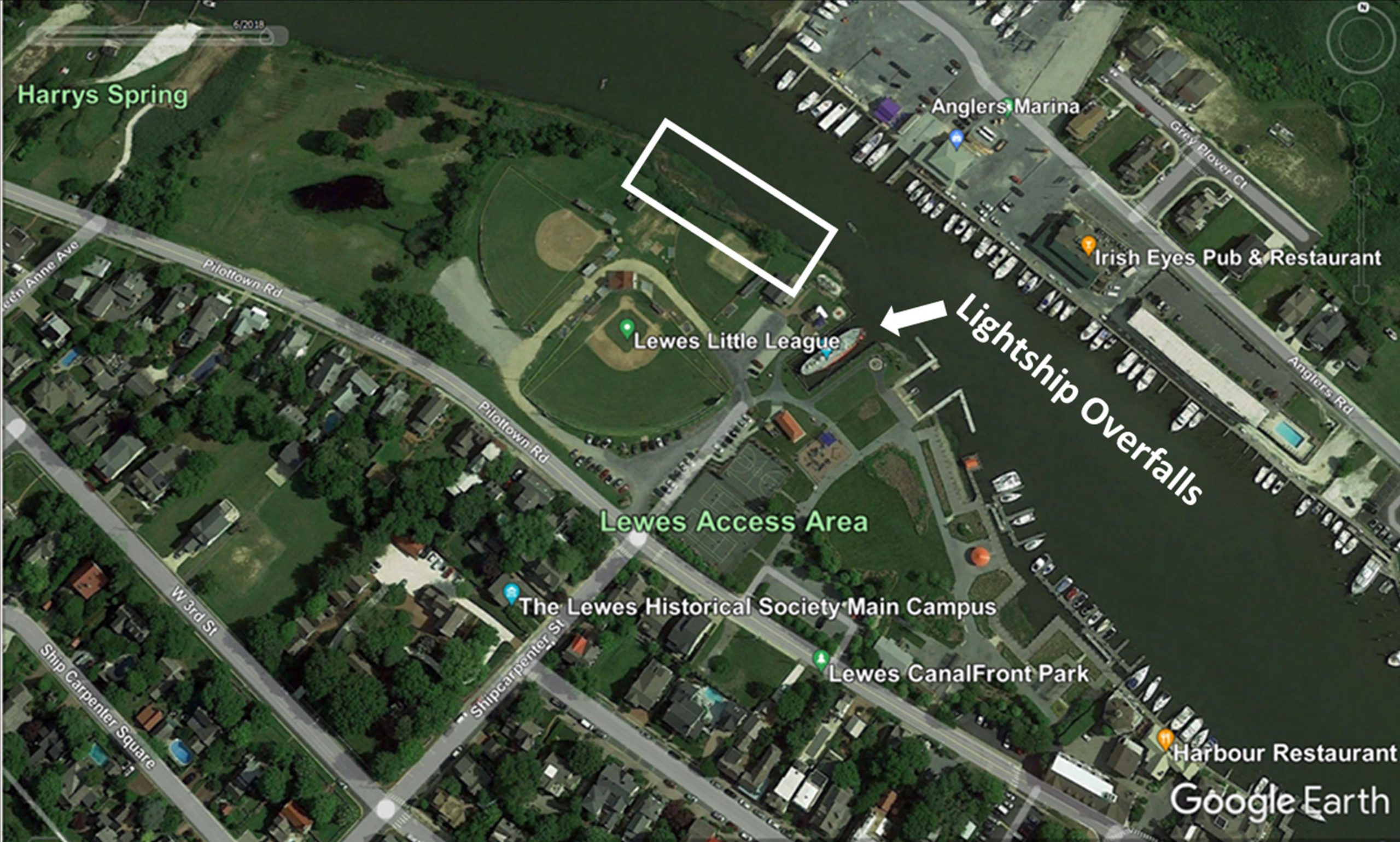
Stopping erosion while supporting natural habitats is not always an easy task. Many of the techniques historically used to stop erosion, such as bulkheads and rip rap, can harm wildlife and reduce usable habitat. Water reflecting off bulkheads can impact the valuable mudflat habitat in front of them, and rip rap can make it difficult for many motile species, such as turtles and horseshoe crabs, to move from the water up into the marsh. Additionally, these types of structures can ultimately sever the connection between the water and the land, reducing the intertidal salt marsh habitat and many of the important services it provides. In 2007, the Partnership for the Delaware Estuary and the Rutgers University Haskin Shellfish Research Laboratory began exploring new living shoreline techniques to provide erosion control with ecological uplift along the Maurice River in New Jersey. The goal of these efforts was to develop a methodology that capitalized on the naturally stabilizing structure of shellfish beds, both oyster and mussel, to reduce erosion. These efforts were of interest to the DNREC Wetland Monitoring and Assessment Program (WMAP), who approached PDE in 2013 to discuss collaborating on a living shoreline project. The renovation efforts with a focus on native habitats that were just beginning along the Lewes waterfront made the ballfields an ideal location to test a living shoreline (Figure 1).
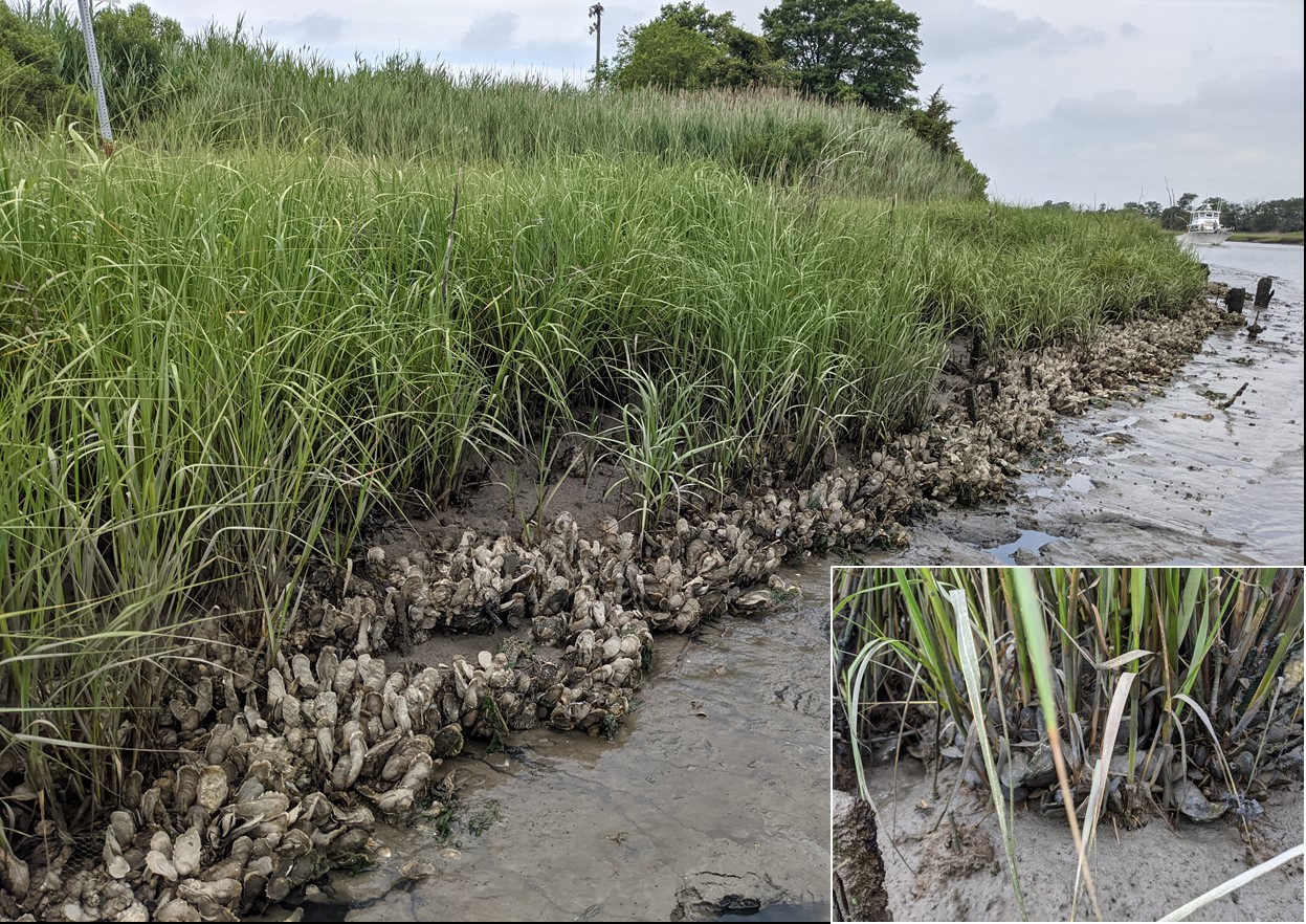
The living shoreline design focused on meeting the dual goals of erosion control and habitat uplift, employing ecologically beneficial materials placed to develop the proper ecological conditions for salt marsh plants and shellfish to thrive. Coir, or coconut fiber, logs were used to shape the waterward edge and build elevation, while recycled oyster shell bags provided protection to the logs and would serve as a home for developing oyster and ribbed mussel communities. In April of 2014, a series of shell bag-lined coir logs were installed in a cusp formation along 92’ of the eroding shoreline (Figure 2b), which was left to trap sediment and build elevation over the following five months, until a second tier of coir logs was added to build additional elevation in October (visible in Figure 2c). Achieving the correct elevation is very important to create the appropriate habitat for the native salt marsh plants that require a certain amount of flooding to survive and prosper. Purchased and salvaged Spartina alterniflora, the native salt marsh cordgrass, was planted in the living shoreline area as trapped sediment continued to build elevation throughout 2014. By the spring of 2015 the planted and pre-existing vegetation were moving into the newly built area (Figure 2c), which was almost completely vegetated by August 2016 (Figure 2d).
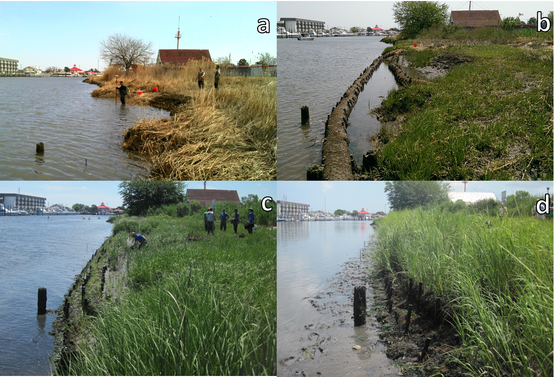
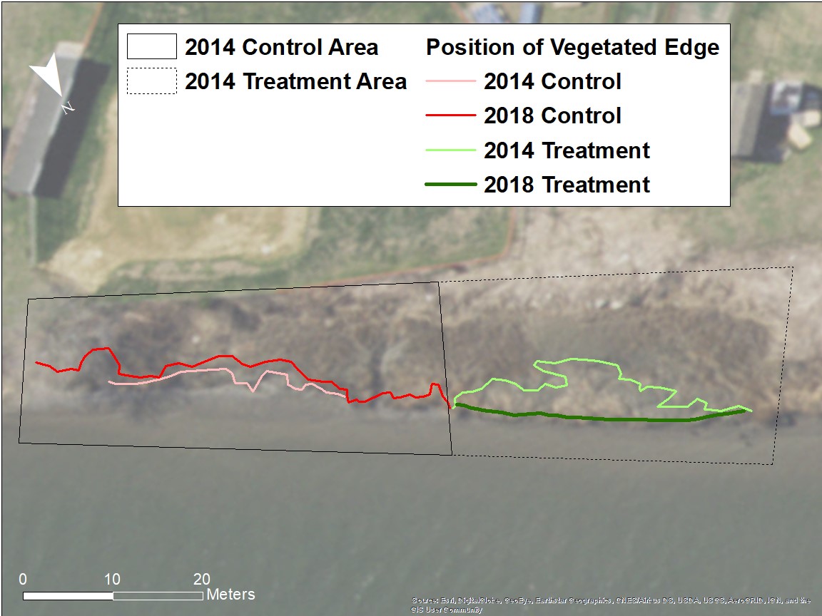
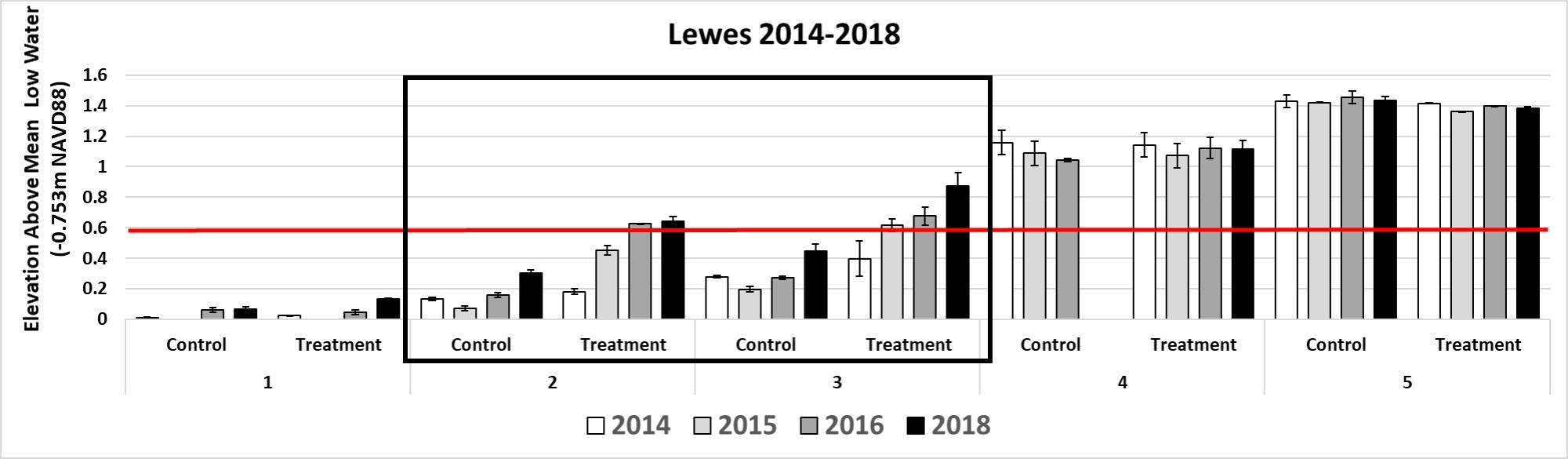
Over subsequent years, annual monitoring quantified the effects of the living shoreline on the horizontal and vertical position of the vegetation, the vegetation’s health, and the shellfish community, relative to no action at a paired control site 50’ to the east. The coir logs remained intact until 2017, when two sections deteriorated and were replaced with recycled oyster shell bags. Overall, the living shoreline was successful in reestablishing vegetation for an overall gain of 1,447 sqft of salt marsh habitat, while its paired control continued to erode (Figure 3). Importantly, the living shoreline was able to build and retain the appropriate elevation for vegetation persistence (Figure 4), and provide suitable oyster and ribbed mussel habitat via the shell bags, which have been densely colonized (Figure 5).
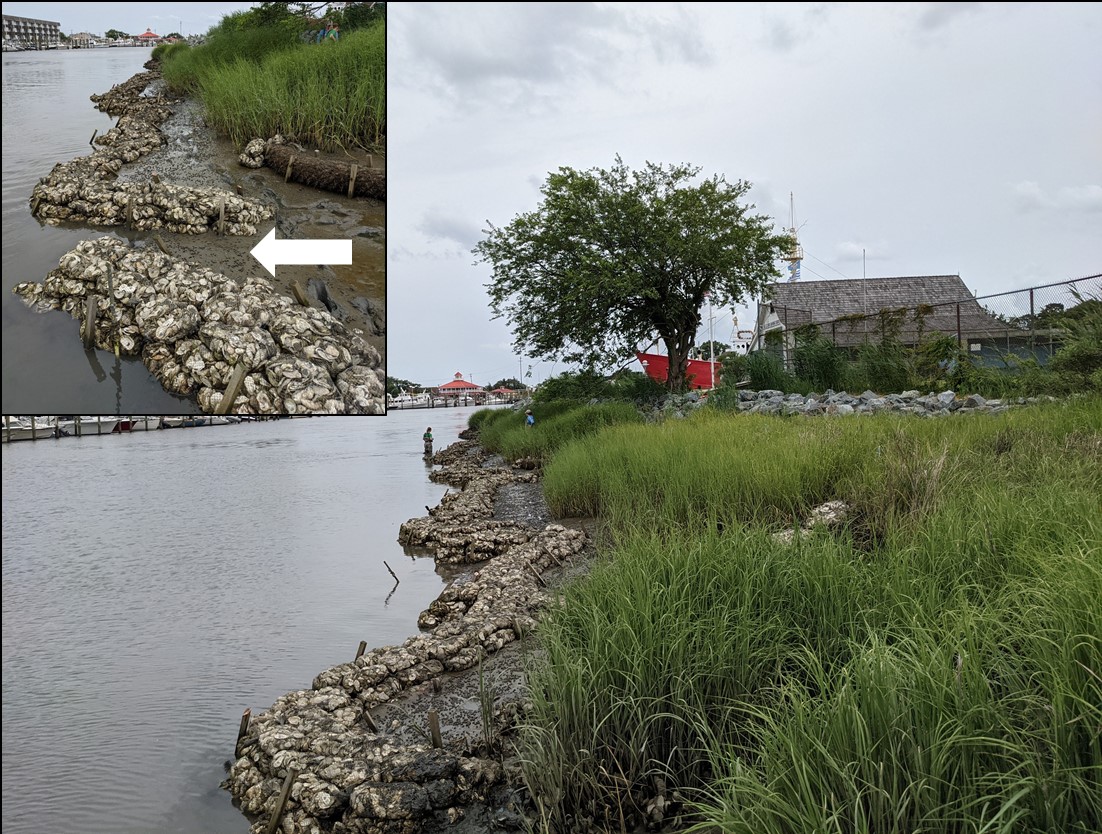
By 2020, the continued erosion along the adjacent control area became dire and encroachment on the Little League fields was imminent. In addition to the erosion, in 2020 a 50’ x 5’ section of marsh separated from the existing marsh and slid onto the mudflat. While the calved vegetation gave the illusion of waterward marsh growth, this unstable sediment and vegetation was highly vulnerable to erosion. Although worrisome, this situation provided an opportunity – if this material was trapped at its current position, over time it would stabilize and grow vertically to help rebuild much of the eroded salt marsh at the control site without relying on the need for outside fill. Concurrently, the USFWS Delaware Bay Estuary Project office had expressed interest in supporting a local living shoreline effort. PDE and DNREC WMAP presented the idea to expand the successful 2014 effort, which was well received, and a new project team was born. Collaboration between the three entities resulted in a design with the goals to stabilize and advance the vegetated edge at eroding area to the extent of the 2014 living shoreline and to provide additional habitat for the now robust oyster and ribbed mussel populations. The Lewes Historical Society (LHS), which owns the property, was very interested in stabilizing the salt marsh using ecologically friendly techniques, and supported the project team obtaining the appropriate state and federal permits. The new design was informed by the successful 2014 installation, while incorporating lessons learned from new living shoreline installations at other locations. As bagged shell has shown great longevity in maintaining position over time, while also providing shellfish habitat and retaining sediment across a multitude of installations, recycled oyster shell bags were selected as the primary construction material.
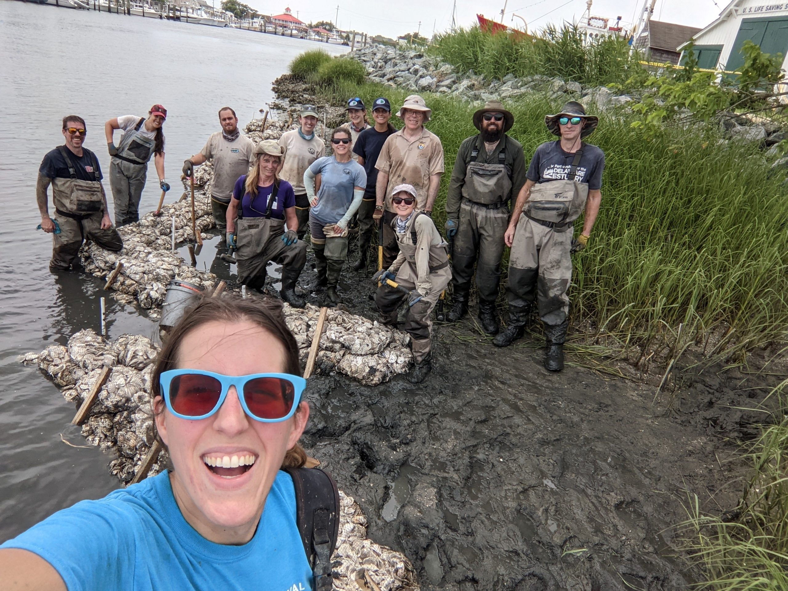
On June 21, 2021 over 1,200 shell bags were placed along 165’ of shoreline and positioned to create five sinuous, overlapping structures between 20’ and 40’ in length and 1.5’ high, with 5’ gaps between them, by PDE, DNREC WMAP, and USFWS DBEP (Figures 6 and 7). The curved formations allow for water drainage and faunal passage while interrupting direct wave passage between structures to the shoreline. Additionally, each structure contains at least one perpendicular “finger” to interrupt water transport and scour along the waterward edge. Finally, at four locations between the shell structures and the existing marsh edge, coir fiber logs were installed to help retain sediment. Annual monitoring will continue along the entire length of the living shoreline, encompassing both the 2014 and 2021 installations, and a seven-year pre-installation data set, will help the project team understand the impact of the newly deployed materials on the ecology. The project team is currently working with the LHS to develop informative signage to educate the many visitors to the waterfront on the goals and ecological importance of living shoreline efforts.

Written on: September 8th, 2021 in Education and Outreach
By Katie Goulder, DNREC’s Wetland Monitoring and Assessment Program
Olympics Big and Small
The 2020 summer Olympic games. We waited an extra year for them to arrive, ready to cheer on fan favorites like Simone Biles and Katie Ledecky in their popular sports of gymnastics and swimming, as well as watch newcomers such as Athing Mu make running 800 m look fun and easy. This exciting international event only happens once every 4 (or in this case 5) years and has us all glued to our TV’s for NBC’s primetime coverage of our favorite sports. But did you know there was a secret Olympics that happened locally every summer?
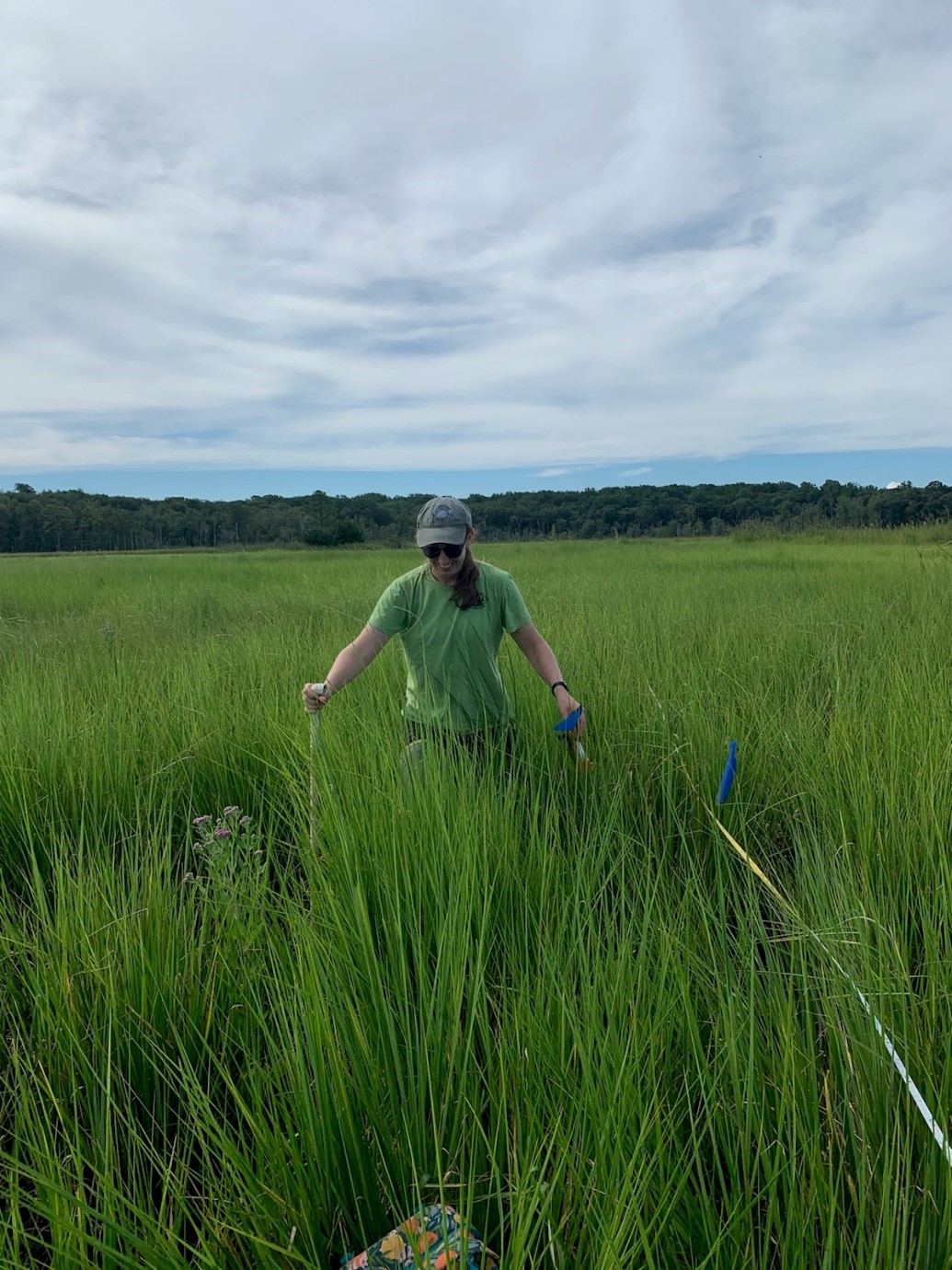
That’s right! The lesser-known Wetland Olympic games happens every field season from late spring to early fall by local environmental scientists throughout Delaware’s many wetlands. As the 2021 seasonal wetland technician, little did I know that in accepting this job that I would also be competing in rigorous, albeit more obscure, Olympic events while performing my fieldwork duties.
Wetland Conditions
During the summer fieldwork season, the DNREC WMAP team is out monitoring and assessing both non-tidal and tidal wetlands throughout the state. Because wetlands come in many shapes and sizes, each site we evaluate presents its own set of challenges. Forested flat? Thick and thorny greenbrier vines ensnare your feet. Tidal mudflat? The mud may be a foot deep or it may be 3 feet deep. And there is no way to know until you take that step. Saltwater marsh? Changing tides can cause a small creek that was easily traversed in the morning to transform into a 4ft deep channel you have to wade through with your backpack over your head. Overall, working in wetlands provides unique opportunities to develop creative solutions to interesting problems. And thus, the Wetland Olympics were born.
The Events
I feel that the Wetland Olympic events emulate those of the actual Olympic Decathlon events in that they necessitate a combination of strength, agility, and endurance. A few of the most common events that the WMAP team competed in this summer include:

These are just a few examples of the athletic feats required of the wetland scientists on a daily basis in order to perform fieldwork in a difficult and dynamic environment.
Going for Gold
All in all, it has been a very exciting season working in wetlands throughout the state. I have learned so much about the different types of wetlands, the methods used to evaluate them and the variety of projects to preserve and protect the wetlands that remain and restore those that have been lost. While we don’t have medals in the Wetland Olympics, I can’t imagine a better team to train and “compete” with in each of these events.

Written on: September 8th, 2021 in Education and Outreach, Wetland Animals
By Kayla Clauson, DNREC’s Watershed Assessment and Management Section
If you’re anything like me and always looking for an adventure, maybe you should check out a tidal salt marsh! I’ll admit – I am slightly biased towards salt marshes due to my professional background, but I’ve exposed many individuals to the wonders of a salt marsh and it always ends up being an exciting trip.
Not only are tidal salt marshes amazing because of their important ecologic services, they are very aesthetically pleasing. Whether you enjoy birding, hiking, exploring, or just getting outside – a salt marsh might be a fun next adventure for you.
Here, I’d like to break down salt marshes for the five senses when you plan on visiting one.
First thing, smell:
I’ll just say it – smell will probably be least favorable on the senses when it comes to visiting a salt marsh. If you’ve ever been outside and stopped to smell the fresh air and instead get a whiff of rotten eggs…chances are you’ve smelled a salt marsh already. This smell happens because the marsh itself is situated on multiple layers of decaying plant materials, called peat. Bacteria that are decaying the dead plants use up a lot of oxygen in the process, creating low oxygen, or hypoxic, sediments. The remaining gas after the decaying process is called hydrogen sulfide – hence the rotten egg smell in the air.
The smells of the marsh vary, and don’t always smell of rotten eggs (unless I’ve gotten used to it at this point). Chances are if you’re in a salt marsh you will experience a mixture of earthy smells, including salt and mud.
Next up, touch:
If you were to walk out into a salt marsh and jump, you’d be quite surprised how that feels*. If you jumped on it, you would feel the hollowness of the peat when you land vibrate through the marsh. It feels very different than jumping on the grass in your backyard or local park. Salt marshes are very spongy, which is why they are so important in protecting us against storm flooding- they soak up excess water before it reaches our homes. If you had a handful of peat and squeezed it like a kitchen sponge, water will fall out!
Let’s talk about hearing:
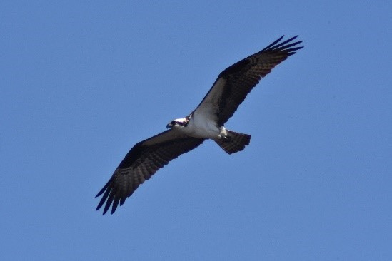
Over the noise of your feet splashing in the creek or sucking into the mud, you’ll hear a suit of bird noises. Common birds you may find year-round are self-explanatory based on their common names, including Salt Marsh Sparrows and Marsh Wrens. There are other common birds that make the marsh a noisy place, such as Willets, Osprey, and Red-winged Blackbirds to name a few.
There’s also lots to see:
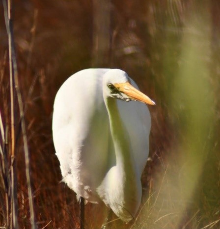
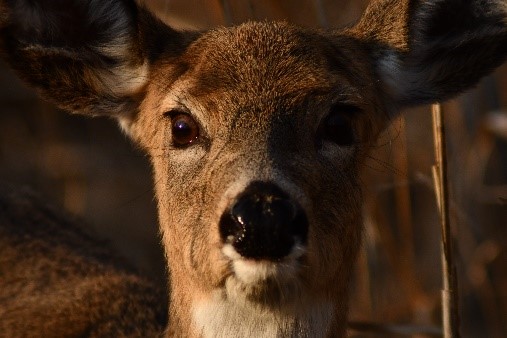
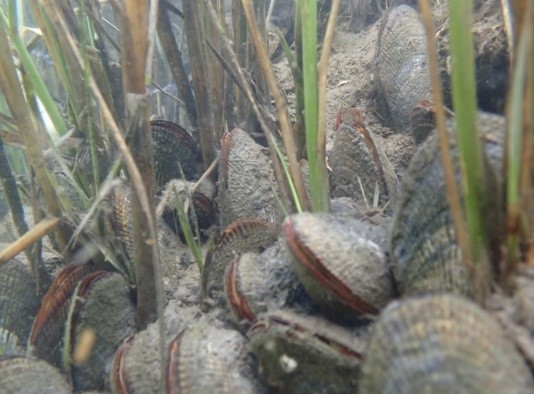
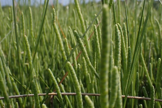
Because they are such an important habitat for wildlife, there is a lot you may encounter when visiting a salt marsh. If you’re looking in the water of a tidal creek, you may find small shrimp, crabs, fish, snails, and horseshoe crabs. As you look outward from the water you will see Fiddler Crabs and their burrows hidden among the Ribbed Mussels and low marsh plants, like Saltmarsh Cordgrass. As you look further outward towards the high marsh, you will see the vegetation shift from Saltmarsh Cordgrass towards the shorter, flatter Saltmarsh Hay. Some mammals including White-tailed Deer, Raccoon or even Mink, may be seen foraging in the marsh.
If you get the chance to observe the variety of salt marsh plants closely, you may see some of them sparkling. This isn’t because they are covered in glitter, rather they are masters of their harsh saline environment and can excrete the salt from the water onto the blades of their leaves.
Best for last, taste:
As ironic as it may be, one of my favorite snacks can be found in the salt marsh! Commonly known as Seapickle, the succulents of Salicornia spp. are often found in the low marsh and are a crunchy, salty snack. If you’re not into eating plants, Blue Crabs might be more appealing to eat due to its savory and tender meat. Blue Crabs are very reliant on tidal marshes for life-cycle development. However, you should cook them first!
A mistake one might make when looking for tasty snacks in the salt marsh is attempting to eat Ribbed Mussels. These bivalves do not taste as good as the popular Blue Mussel because of the high concentrations of sulfur they filter from the marsh. However, you may be able find other tasty bivalves, such as Oysters or Hard Clams, around a salt marsh in deeper water.
To wrap up:

Now that you’re prepared for some of the senses you will experience in a salt marsh, you may want some packing tips for your visit. I recommend:
* Helpful hint: I do not recommend walking around in a salt marsh, they can be tricky places if you’ve never done it before! Instead, try visiting an educational facility with trails to experience the marsh. Some great marshes to visit are at St. Jones Reserve or Bombay Hook
Delaware's Governor
State Agencies
Elected Officials
General Assembly
Delaware Courts
State Employees
Cities & Towns
Delaware State Code
State Regulations
Business First Steps
Phone Directory
Locations Directory
Public Meetings
Voting & Elections
Transparency
Delaware Marketplace
Tax Center
Personal Income Tax
Privacy Policy
Weather & Travel
Contact Us
Corporations
Franchise Tax
Gross Receipts Tax
Withholding Tax
Delaware Topics
Help Center
Mobile Apps
E-mail / Text Alerts
Social Media

Built by the Government Information Center
©MMXVIII Delaware.gov

