Facebook Twitter Instagram YouTube

Written on: September 29th, 2026 in Education and Outreach, Natural Resources
By Olivia Allread, DNREC Wetland Monitoring and Assessment Program
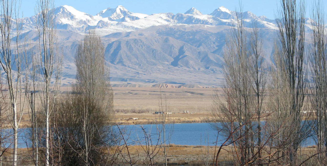
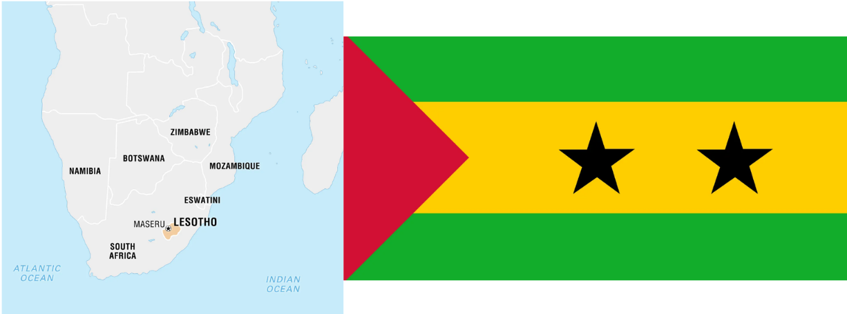
When is the last time you looked at a world map? Do you know where the country of Lesotho is located? Or what the Sao Tome and Principe flag looks like? Yeah, of course not, neither did we. This blog post started as a brain exercise to find mapped wetlands in different countries and turned into a quest to share the world’s largest network of protected areas. Yes, you heard that right – the world’s largest network of protected areas – and they’re all wetlands. From Albania to El Salvador, Fiji to Kyrgyzstan, wetlands of many shapes and sizes exist within an intergovernmental treaty that has been in place for over 50 years. Now we can’t visit every site across the globe in one blog, so let’s explore the “who”, “what”, and some of the “where” of Wetlands of International Importance.
How it Came to Be and Getting Designations
Let’s go back to in time to when this whole idea started. From the 1960s until the early 1970s, there was major global concern about the increasing loss and degradation of wetland habitat, particularly in reference to migratory waterbirds. The concept of protecting these areas on a global scale came to fruition as a treaty at the first Ramsar Convention, also known as the Convention on Wetlands, that was held in 1971. Taking place in the Iranian City of Ramsar (hence the name), countries and non-governmental organizations signed and adopted the treaty that then went into effect in 1975. Since it took force, the Mission of the Convention has been “the conservation and wise use of all wetlands through local and national actions and international cooperation, as a contribution towards achieving sustainable development throughout the world.”
This treaty is not a “set it and forget it” policy. Though it is based around voluntary commitments, the signing parties must abide by an official, globally recognized framework for identifying the wetlands they find most important as well as the proper management of said habitats. All parties or countries that join stick to core pillars of conservation and wise use of their sites that include sustainable practices, mapping boundaries, determining ecological value, national planning, education, international cooperation, and longevity of all wetlands in their territory – even outside of the designations. To receive a Ramsar wetland designation, you must fulfill at least 1 of 9 specific criteria, with the first being centered around rare or unique wetland types, while the other 8 focus on biological diversity and ecological communities within the wetland site. Though they read easily on paper, these criteria are based on highly developed scientific methods and specific evaluations of biological communities in wetland habitats. Or simply put, it’s based off serious science!
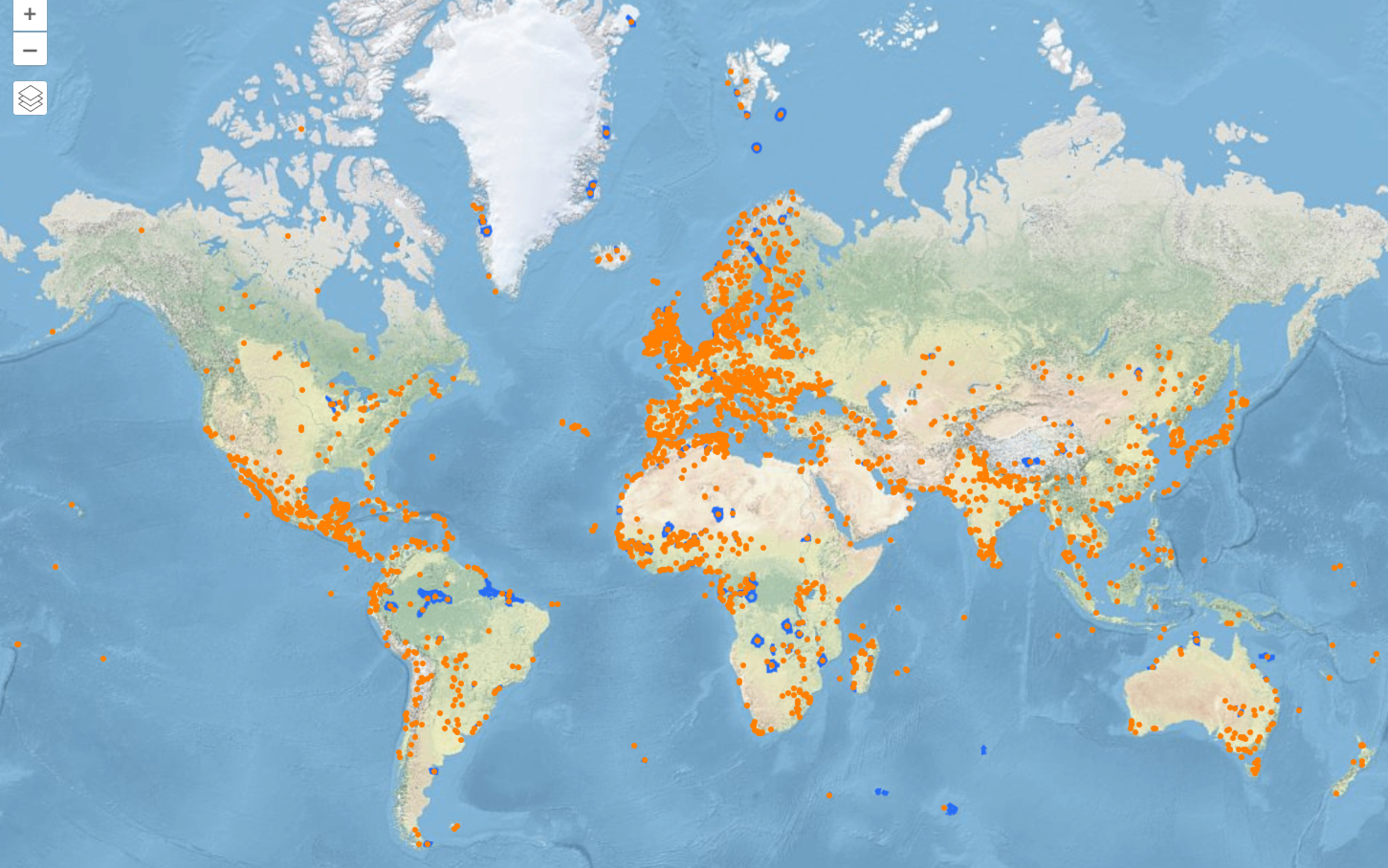
Flash forward another 55 years and boom, designated wetlands galore! There are approximately 2,533 Ramsar Sites in 172 Convention contracting parties across the world, covering almost 625.5 million acres of land. This network of areas includes wetlands in over 40 specific types of habitat classifications, within 3 broad categories of marine/coastal wetlands, inland wetlands, and human-made wetlands.
Zoom In to the United States
To date, there are 41 Ramsar Sites totaling over 4.6 million acres in the United States, with over half of these sites completely in or partially within our U.S. Fish and Wildlife Refuges. These spaces are sanctuaries recognized for their uniqueness, rarity, and importance for conserving biological diversity. Like many countries, the United States has an International Affairs program, housed within the U.S. Fish and Wildlife Service, who oversees designating Ramsar Sites in our borders. Their main goal is to identify and nominate wetlands for designation, while including input from partners, then research and monitor them to ensure their longevity for the future. Someone needs to make sure we’re following the rules.
As of recently, the environment in our country is under siege. We’re up against major shifts in policy and regulation, experiencing impacts from the climate crisis, and seeing our natural resources on the chopping block. During these tough times, it’s easy to forget the incredible work that has been done, and is still being done, for the protection and conservation of our habitats. Luckily, at least for now, we’re still a contracting party to the Ramsar Convention…
A Quick and Dirty Tour
Since we can’t highlight the thousands of Ramsar Sites across the world, let’s look at some of the standout areas we discovered during our research.
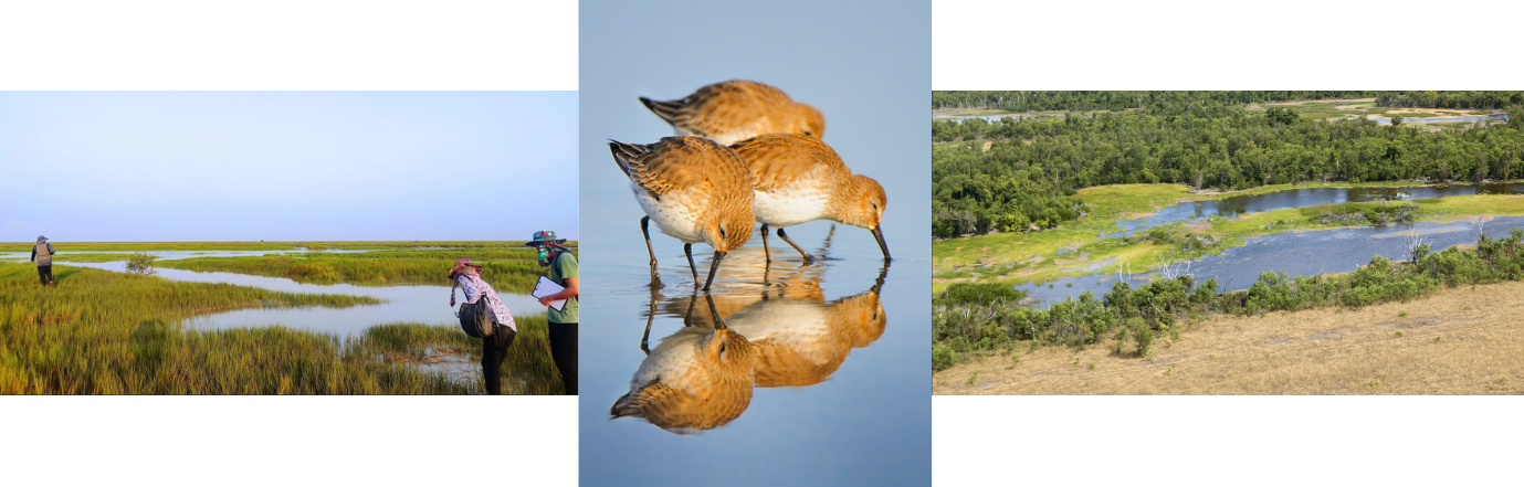

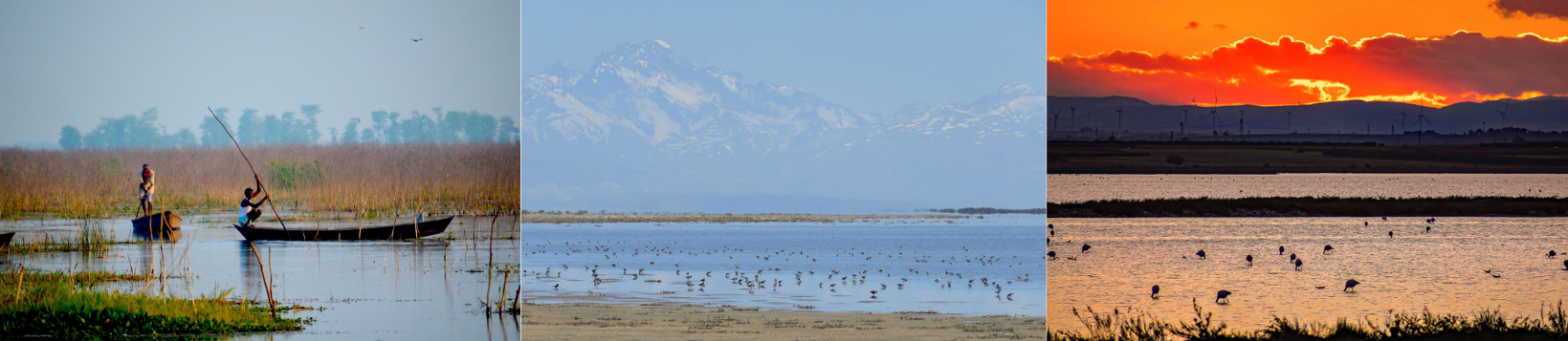
Now if you really want to dig into the Ramsar Sites, you can tour all of them on the Convention’s Site Information Service mapping tool. But make sure your brain is ready! It’s a hefty tool that provides everything from designation dates to management plans, wetland types to threats each one is facing. Being a part of the Convention on Wetlands is a lifetime commitment to the resource – it holds contracting parties to a standard of understanding and protection. When browsing these photos, reminders as to why wetlands are truly one of a kind popped up everywhere. The glimmers of wetland appreciation across the world shine bright through the Ramsar Sites and give wetlands of all types a platform to be seen.
Oh, and in case you were still wondering – the location of Lesotho and Sao Tome and Principe flag are below. You learn something new every day.

Written on: September 29th, 2026 in Wetland Animals, Wetland Research
By Tess Danielson, D.C. Department of Energy and Environment
When the sun goes down across Washington, D.C., another part of the city comes alive. Along streams, ponds, marshes, and wooded wetlands, frogs and toads begin calling. Their voices can be easy to overlook amid the sounds of an urban environment, but for participants in the District Department of Energy and Environment’s (DOEE) FrogWatch program, those nighttime calls are valuable scientific observations.
FrogWatch gives District residents an opportunity to become community scientists, helping document amphibian activity while learning more about the health and diversity of local wetland habitats.
Over the past decade, the program has built a growing record of what is heard. This past year alone, 184 volunteers helped collect data. Results are added to the FrogWatch Fieldscope dataset with thousands of other observations from across the nation.

What Is DOEE FrogWatch?
DOEE FrogWatch is a local chapter of FrogWatch USA, a national citizen-science program.
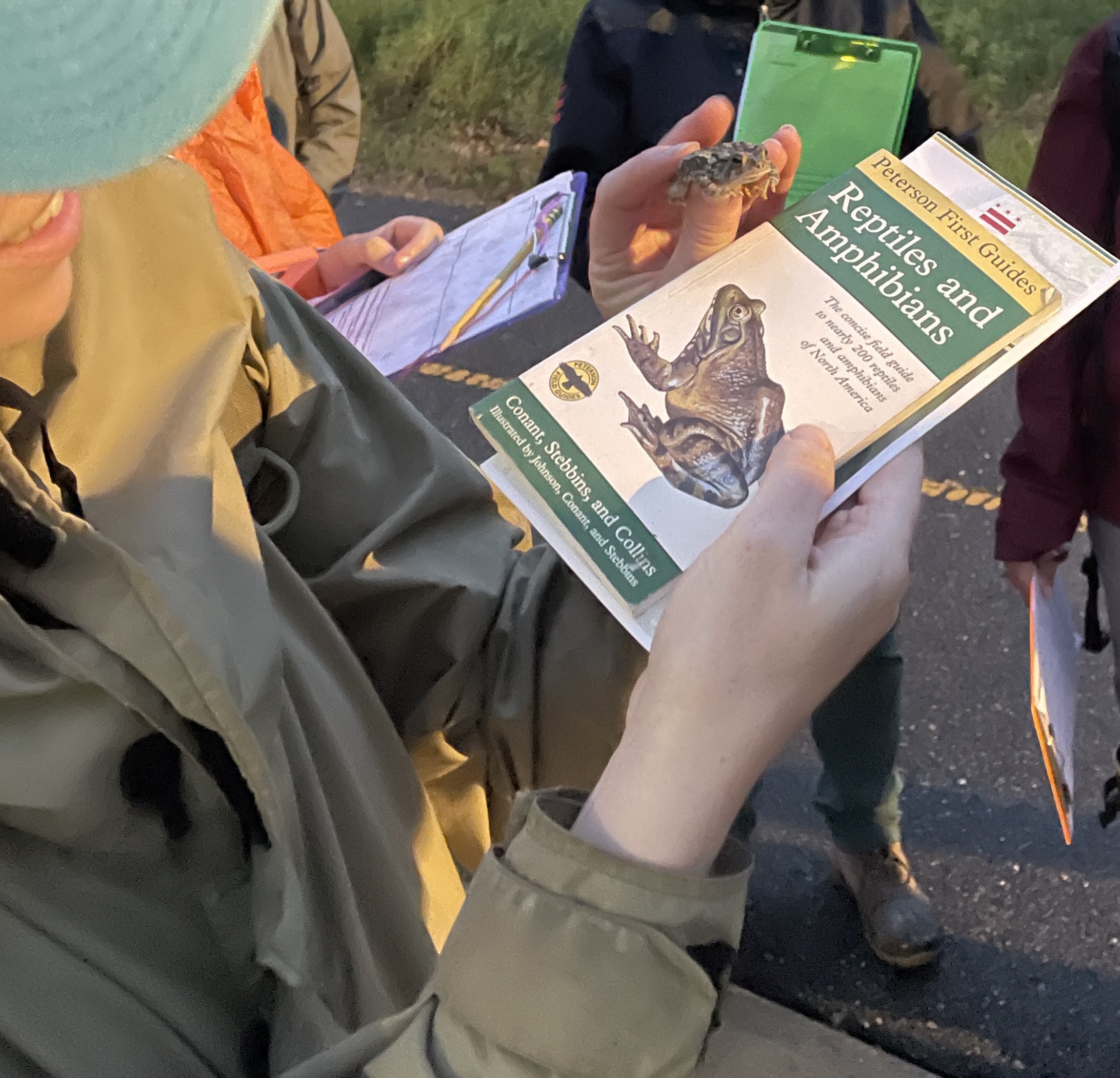
Rather than requiring volunteers to capture or even see an amphibian, FrogWatch uses something much simpler: careful listening. Participants learn to recognize frog and toad calls and conduct monitoring visits at designated wetland sites.
DOEE staff hold a public training session to prepare volunteers to learn the data collection method and the 13 different frog and toad calls that could be heard in the District.
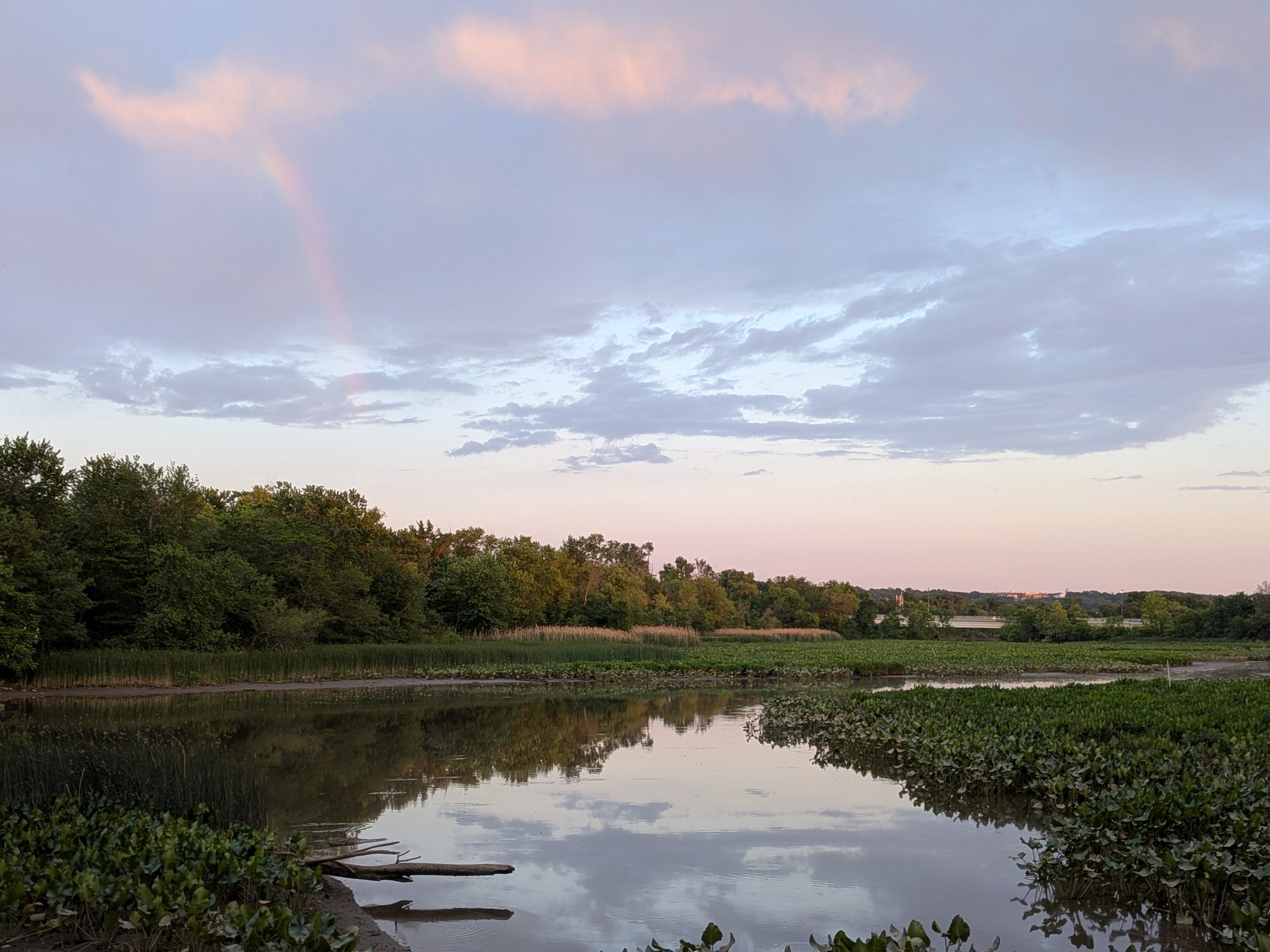
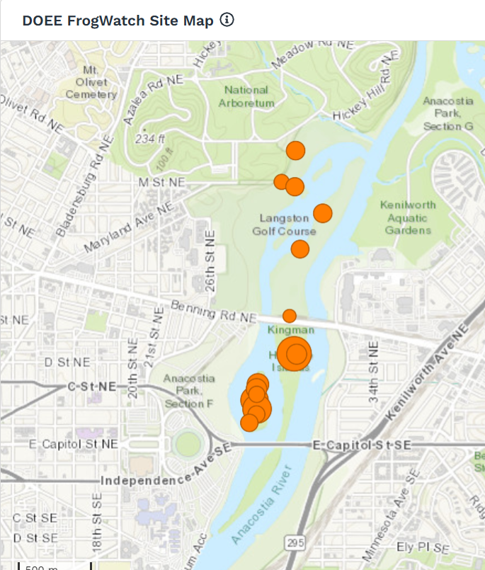
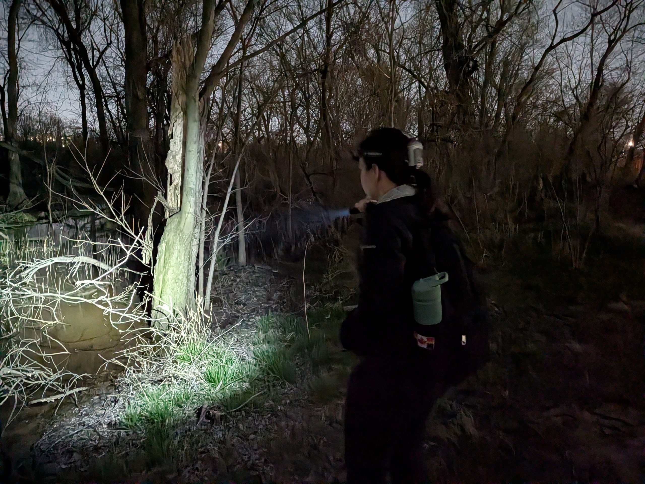
Monitoring nights are held once a month from March to August since species activity changes over the breeding season. Volunteers gather just before sunset at Kingman and Heritage Islands to meet DOEE staff, educators, and rangers from Living Classrooms Foundation. As a group, they set out to designated aquatic habitat sites and conduct a three-minute listening survey at each site, recording the frog and toad calls they hear. Along the way and throughout the season, volunteers also encounter enchanting lightning bugs, swarming bats, swimming beavers, and the distinct heavy buzzing sounds of summertime insects.
Elaina, an educator at Living Classrooms, reflects on her experience:
“While our priority is to teach the public about amphibian biodiversity on the Islands, our FrogWatch meetings set the stage for unique experiences beyond the data. For many of our volunteers this year, FrogWatch was their first time visiting Kingman and Heritage Islands. They loved that their first experience of the Islands was at night, under a full moon, spotting nocturnal wildlife with fellow nature-enthusiasts. It was incredibly heart-warming to offer such a memorable introduction for them. We also have a handful of volunteers that have joined us for every FrogWatch this year, and they most often told me that while they joined for the frogs, they returned for the people. For us, the most rewarding part of FrogWatch is creating a space where conservation leads people to find their community.”
Why Listen for Frogs?
Frogs and toads play important roles in wetland ecosystems. They are part of aquatic and terrestrial food webs and depend on healthy habitat for breeding and survival. Amphibians are known as indicator species because of their sensitivity to environmental changes like water pollution and temperature. Monitoring their presence and calling activity can therefore contribute to our understanding of local ecosystems. It can also help answer questions like:
For an urban jurisdiction such as Washington, D.C., this type of monitoring is particularly valuable. Wetlands are embedded within a landscape of neighborhoods, roads, parks, trails, and waterways. The impact of human stressors on wetlands is more pronounced in this urban space, so monitoring their health through biological indicators is critical. The good news is that we’re seeing frogs show up, demonstrating even more that urban wetlands provide critical functions!
A Decade of FrogWatch Observations and the Value of Long-Term Monitoring
The FrogWatch FieldScope data provide a decade-long record of monitoring.
From 2016 through 2026, there have been 319 observations at Kingman and Heritage Islands and Langston Golf Course. Among those monitoring nights, observations have varied from silence to a full chorus.
For FrogWatch volunteers, the full choruses can be among the most memorable monitoring experiences. Instead of hearing an occasional individual call, volunteers may encounter a continuous soundtrack in which calls overlap and become difficult to distinguish from one another.
A monitoring visit during which no frogs are heard does not necessarily mean that amphibians are absent from the habitat. That three-minute recording window does not capture the whole story. Calling activity and intensity can change with weather, temperature, precipitation, time of year, and breeding conditions.
From a data perspective, both experiences matter. A quiet survey and a loud chorus each contribute to the long-term record, so repeated monitoring is essential. Maintaining consistent observations allows for a better opportunity to distinguish ordinary seasonal variation from longer-term patterns. In other words, FrogWatch turns an ordinary nighttime walk into a small scientific field study.
Hop to it and answer the call!
For anyone interested in wildlife, wetlands, or engaging in science, FrogWatch offers a unique way to get involved. Residents aren’t simply learning about conservation, they are participating in it.
For current volunteer information to join in on the fun, visit DOEE’s FrogWatch program information. To look for a chapter near you, or to learn how to start your own, visit the FrogWatch USA Volunteer site.
Delaware's Governor
State Agencies
Elected Officials
General Assembly
Delaware Courts
State Employees
Cities & Towns
Delaware State Code
State Regulations
Business First Steps
Phone Directory
Locations Directory
Public Meetings
Voting & Elections
Transparency
Delaware Marketplace
Tax Center
Personal Income Tax
Privacy Policy
Weather & Travel
Contact Us
Corporations
Franchise Tax
Gross Receipts Tax
Withholding Tax
Delaware Topics
Help Center
Mobile Apps
E-mail / Text Alerts
Social Media


Built by the Government Information Center
©MMXVIII Delaware.gov

