Facebook Twitter Instagram YouTube

Written on: May 25th, 2022 in Wetland Animals, Wetland Research
By Kayla Clauson, DNREC’s Watershed Assessment and Management Section
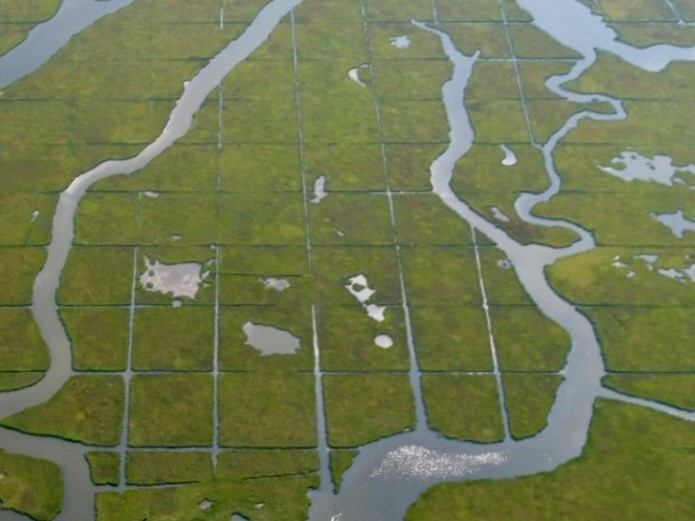
Wildlife cameras are a tool scientists can use to collect wildlife field data. Often, scientists go out in the field and conduct monitoring that gather similar data but are restricted because they only get a small snapshot of their target observations. For example, a field crew will observe all birds using a salt marsh during marsh bird surveys, which are conducted early morning at sunrise when there is low tide. This typically gets done three times a year, when birds are likely to be most active. Using wildlife cameras allows scientists to capture birds that are using the project area during the entire year, all hours of the day and night. Although wildlife cameras are not a perfect tool, they allow scientists to actively capture data with minimal disturbance to the animals as well as gather data over a longer period.
The target of this monitoring is to better understand wildlife habitat utilization at both our reference (salt marsh) and project (mudflat) sites. The goal is to see how animal usage may compare long-term between the two sites before marsh recreation occurs (current), during the reconstruction and afterwards. To get a better understanding of the entire project and other current monitoring, check out this previous blog post.

Our wildlife cameras have captured a variety of both mammals and birds. Let’s take a look at the birds we’ve captured for now.
Duck, Duck, Goose…
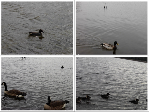
Family: Anatidae – Ducks, Geese, Swans.
Although waterfowl aren’t the primary targets of this study, we capture a lot of interactions of birds in the Anatidae family. Some of the common Anatidae family we’ve captured are Canada Geese (Branta canadensis), Mallard (Anas platyrhynchos), Green-Winged Teal (Anas crecca), and Hooded Merganser (Lophodytes cucullatus). These birds can be seen mostly around high tide, while swimming or eating.
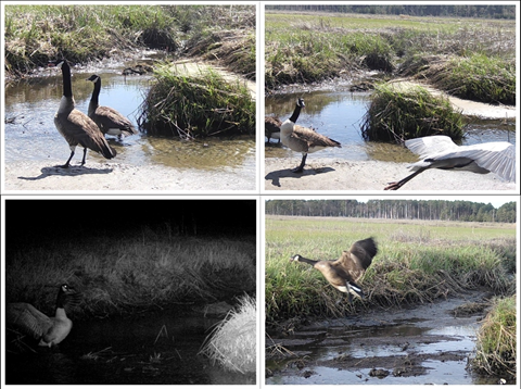
Anatidae Highlight
There has been a Canada goose pair nesting at our reference site. They have been named Honk and Tonk. Honk is the male goose (gander) and can be distinguished in most of the photos as he is a fierce protector of his female partner, Tonk. While she is incubating, she won’t be leaving her nest often until her eggs hatch. Since they are nesting in front of the camera, many of the captures at this site will be of them and can skew our data. However, scientists can use their best judgement on data recording of these two individuals.
What’re you laughing at?
Family: Laridae – Gulls, Terns, Skimmers.
The second most common birds we see a lot of are gulls and terns. Gulls can be seen in the project area mostly at low tide foraging on the mudflat. Gulls can be challenging to identify due to similar morphology, coloration, and juvenile plumage. For data collection gulls were identified down to their family name (Laridae), except for Laughing Gulls (Leucophaeus atricilla). Named for their laugh-like call, Laughing Gulls are easily distinguished from other gulls because of their black head. In addition to Laughing Gulls, some common gulls and terns include Herring Gulls (Larus argentatus), Ring-billed Gulls (Larus delawarensis), Forster’s Tern (Sterna forsteri), and Common Terns (Sterna hirundo).
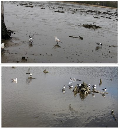

Laridae Highlight
Terns are known for their aerial dives when foraging for fish below the waters surface. Although terns are not typically found walking around the mudflat like gulls, we’ve been fortunate enough to capture some of their aerial dives on camera with a big splash!
Heron Paparazzi
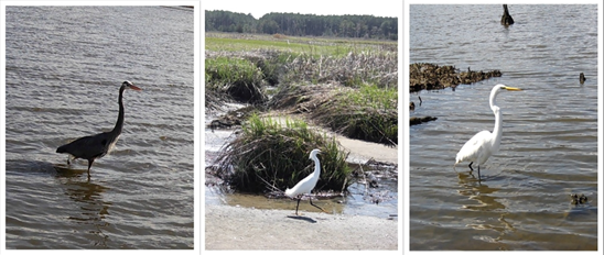
Family: Ardeidae – Herons, Egrets, Bitterns
The third most common family we observe are herons and egrets in the Ardeidae family. One of our most seen birds during our monitoring are Great Blue Herons (Ardea herodias). We’ve also captured Great Egrets and Snowy Egrets- but with a lot less captures. We hope as the cameras remain out, we will capture more secretive marsh birds, such as the Least Bittern or American Bittern.
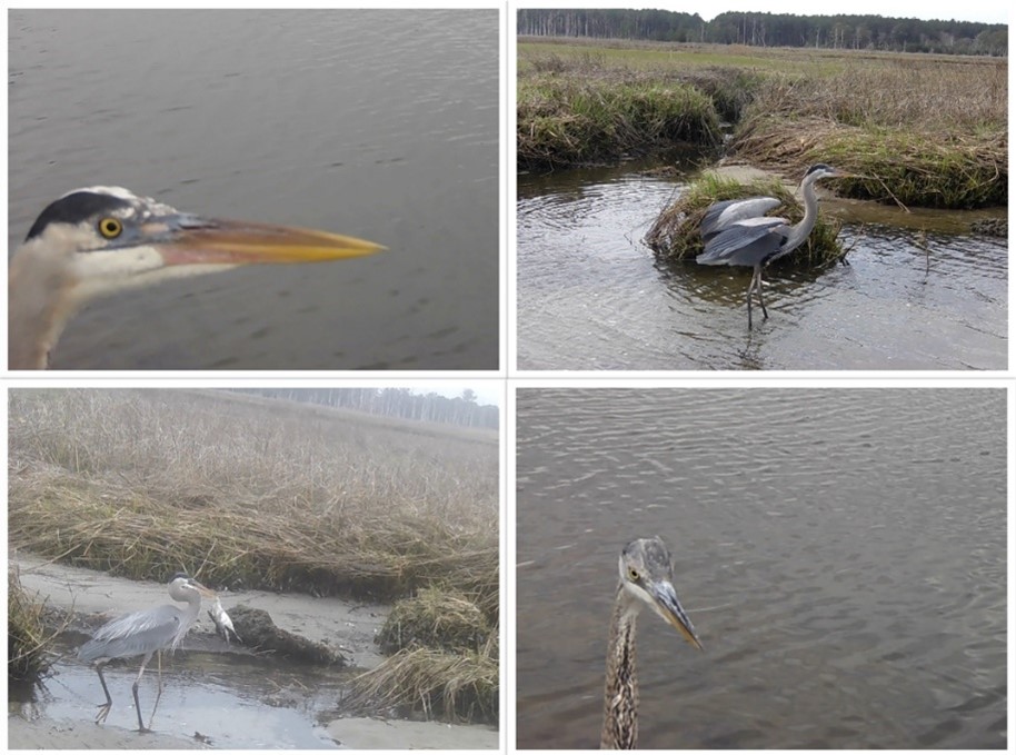
Ardeidae Highlight
Standing about four-feet tall with a six-foot wingspan, Great Blue Herons are quite the impressive bird. Known for their huge size and stalking behavior alongside coastlines and waterways, they also turn out to be quite photogenic. Many photos captured include Great Blue Herons observing the cameras closely, seemingly posing, or showing off the large fish they can catch.
Talon-ted birds
Family: Accipitridae- Hawks, Eagles, Kites
The last birds to discuss that are often captured in our project are hawks and eagles. We are fortunate enough to have captured Northern Harriers (Circus hudsonius) and Bald Eagles (Haliaeetus leucocephalus). We see Northern Harriers flying low along the marsh looking for prey, such as small mammals, in the grasses. Bald Eagles can be spotted soaring with fish or showing off their talons.
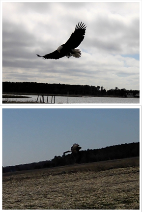
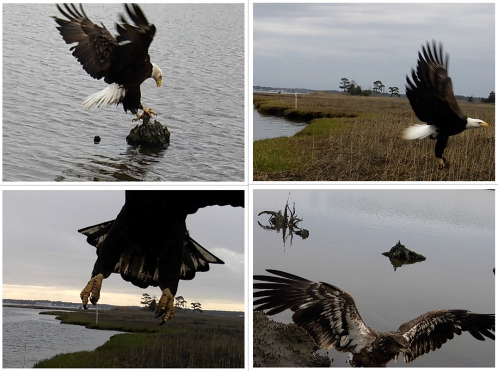
Accipitridae Highlight
Best known for their patriotic symbolism for the United States of America, Bald Eagles are a frequent capture at our reference and project sites. We can distinguish both adult and juvenile Bald Eagles from each other based on the coloration of the feathers. Adult bald eagles are dark brown with a white head and tail, whereas juveniles are fully brown in coloration and do not have a fully white head until about 5 years of age.
Birds of a Feather
Some other birds we capture are Yellow Legs (Tringa melanoleuca), Clapper Rails (Rallus crepitans), Turkey Vultures (Cathartes aura), and Cormorants (Nannopterum auritum). Yellow legs belong to the family Scolopacidae, while Clapper Rails belong to Rallidae. These are both birds that directly utilize the marsh for hiding and foraging. Cormorants in the family Phalacrocoracidae are seen swimming at high tide and Turkey Vultures in the family Cathartidae are seen scavenging for food.

Stay tuned to learn more about what we capture on our wildlife cameras next time when we explore mammals on the marsh!

Written on: May 25th, 2022 in Wetland Assessments, Wetland Restoration
By Erin Dorset, DNREC’s Division of Fish and Wildlife
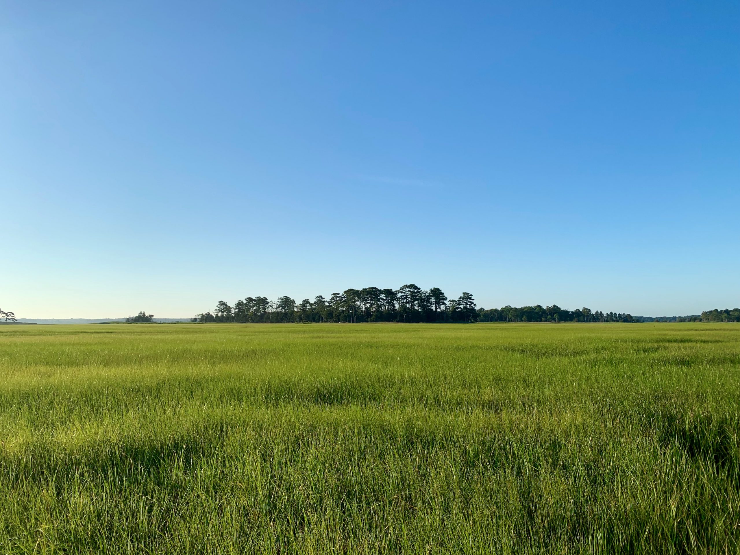
The Inland Bays are a beautiful and beloved part of Delaware, containing about 20% of the state’s wetlands. Those wetlands are important economically, culturally, and ecologically, as they improve water quality, support commercial and recreational fisheries, support tourism, absorb flood waters, and provide crucial feeding and nursery habitat for wildlife. However, the Inland Bays are also home to agriculture and booming development, and sea-level is projected to keep rising in the region, all potentially having negative effects on wetland acreage and health.
In light of all this, DNREC’s Wetland Monitoring and Assessment Program (WMAP) recently investigated the major problems that wetlands in the Inland Bays face and the best paths forward to ensure that wetlands in the bays are around for generations to come, creating an Inland Bays Wetland Restoration Strategy. To do so, WMAP gathered relevant existing data and reports, including their own tidal and non-tidal Inland Bays wetland condition reports, used expert input to list out the major issues and potential solutions, and used GIS mapping software to identify prime spots where wetland restoration could make improvements.
The Issues
Within the Inland Bays Wetland Restoration Strategy, WMAP identified the major issues that tidal and non-tidal wetlands face in the Inland Bays. They include:
A Path Forward
After reviewing the worst issues that wetlands are dealing with in the Inland Bays, WMAP outlined tactics in the restoration strategy that are likely to be the most effective at tackling those problems:
Learn More
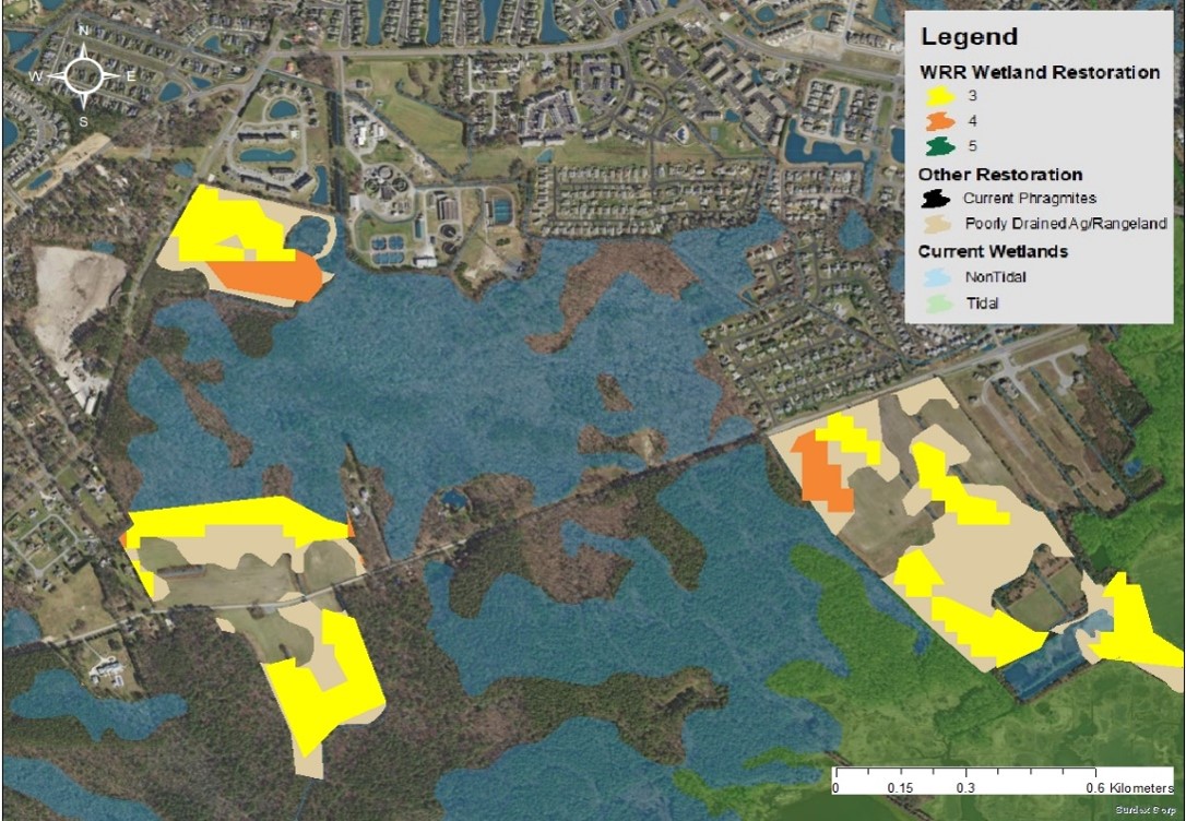
If you want to get into the weeds and know all the details, you can see the full Inland Bays Wetland Restoration Strategy, now publicly available! Spoiler alert: the full report contains information not only about tidal and non-tidal wetlands, but also about submerged aquatic vegetation (SAV) in the Inland Bays, including widespread problems faced by SAV and tactics to address those issues. You can also explore maps showing potential wetland and SAV restoration areas on public, protected lands in the full report, such as the one shown here. Restoration maps presented in the strategy combined spatial data from the Delaware Watershed Resources Registry (WRR) with other existing spatial data, including current wetlands, highly suitable marsh migration lands, areas containing P. australis, and poorly drained agricultural or rangelands.

Written on: May 25th, 2022 in Education and Outreach
By Olivia McDonald, DNREC’s Wetland Monitoring and Assessment Program
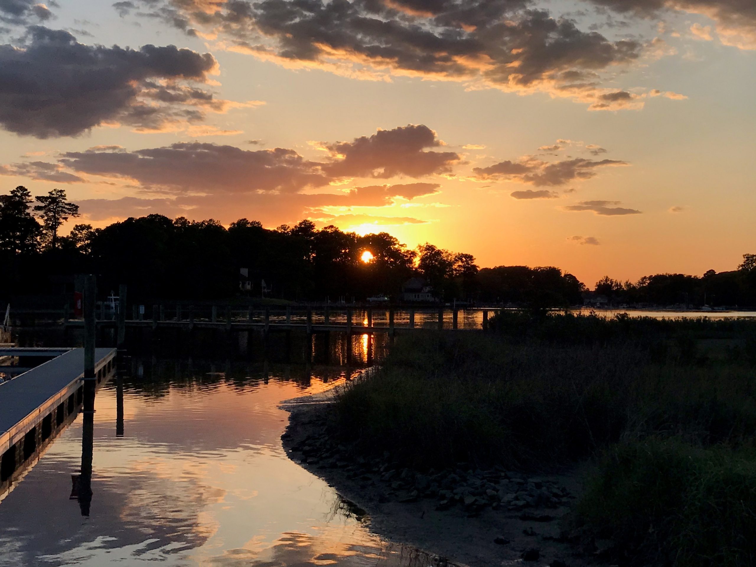
As you drive through the coastlines of Delaware and roll down your windows, you’re greeted by a view like no other. You spot an expansive marsh on your right, opening to a vast bay filled with boats and glistening with sunshine. Most of us know that feeling – you’ve made it to the coast. But let’s take a look beyond the beauty. Past your binoculars and deep within a coastal wetland habitat that is hard at work.
According the to Environmental Protection Agency (EPA), “Coastal wetlands include saltwater and freshwater wetlands located within coastal watersheds – specifically, USGS 8-digit hydrologic unit watersheds which drain into the Atlantic Ocean, Pacific Ocean, or Gulf of Mexico.” These land areas are permanently or seasonally inundated with fresh, brackish, or saline water. The plant community contains a variety of species that are uniquely adapted to the degree of inundation, the type of water that is present, and the soil conditions.
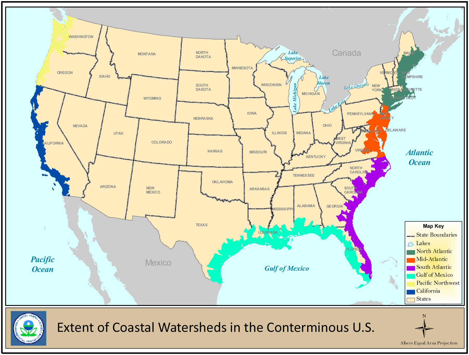
Don’t let the word “coastal” trip you up too much. In this case, we’re talking about wetlands that can be tidal and non-tidal, and freshwater or saltwater. Types of coastal wetlands include, marshes, salt marshes, seagrass beds, freshwater marshes, swamps, bottomland hardwood swamps, and mangrove swamps and forests. What is clear from Map 1 is that coastal wetlands can in fact extend many miles inland from the edge of the coast. Each wetland’s condition within the watershed depends on the influences and health of the surrounding watershed. Some of these areas are not small in nature, and can impact large portions of one or more states.
So what’s the big deal?
To understand the value of coastal wetlands, we need to understand the benefits. Ecosystem services can help us quantify those benefits that these habitats provide and show us how they impact our everyday lives. Let’s take a look at these essential services to people and the environment.
Clean Water
Ah, nature’s water purification system. Coastal wetlands, and really wetlands of all kinds, filter sediment and absorb pollution from outside influences. Runoff from hard surfaces, being a leading cause of pollution, is combated head-on through wetlands. Extra nutrients and pesticides contributed by development and agriculture are filtered out so they don’t enter local waterways. Wetlands simply trap and filter these impurities, helping maintain healthy waters.
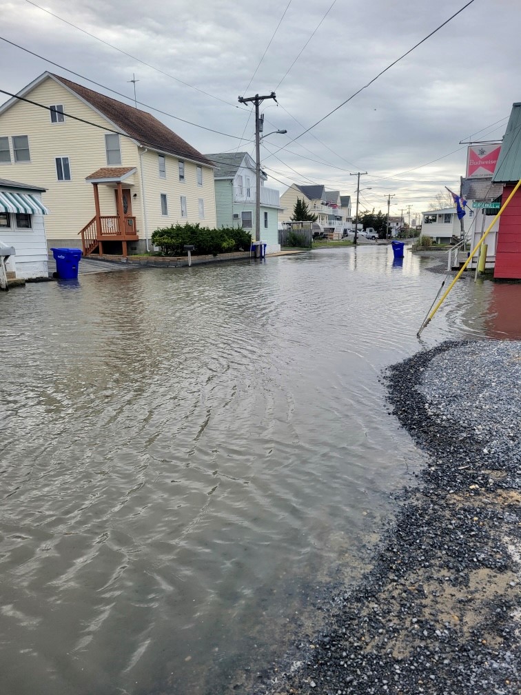
Flood or Storm Protection and Erosion Control
If you live in Delaware, you’re going to really appreciate this one. Coastal wetlands are the first line of defensive during storms or floods for residential and commercial property. By holding back amounts of floodwaters and slowing the rate that water enters a system, wetlands can reduce the severity of negative impacts from severe weather events. Coastal wetlands can also prevent coastline erosion due to their ability to absorb destructive wave energy. Being able to dissipate energy created by ocean waves or water movement helps to slow the degradation of a shoreline. For the first state this means protecting people, land, infrastructure, and agriculture from devastating damages.
Carbon Sequestration
As the effects of climate change increase, the need to remove greenhouse gases from the atmosphere becomes more vital for our planet’s future. Certain coastal wetlands, such as salt marshes and seagrass beds, play an important role in decreasing that release. It’s a term we call coastal blue carbon – carbon dioxide that is absorbed and stored in specific coastal ecosystems. These habitats capture and store the gas from the atmosphere in both plants and soil, and even sequester more carbon dioxide than they release. Though the science behind it all is intense, the results can be more simply understood. Coastal wetland ecosystems have a natural ability to reduce the effects of climate change.
Recreation and Tourism
Each coastal wetland is distinct in the habitat it provides, and those areas aren’t just for wildlife. Wetlands provide the public and landowners alike a myriad of opportunities for recreation. From bird watching to hunting, hiking to photography, these ecosystems open the door for people to experience nature. The ever-growing tourist industry centered around Delaware’s beaches do more than just trickle down to hotels, restaurants, and local businesses. With an intricate coastline stretching the length of the entire state, impacts from growth are being seen throughout all three counties. Our coastal habitats are a major economic drivers for a variety of communities job growth and revenue.
Sustainable Fisheries
Imagine your favorite seafood dish. Where do you think it comes from? Many kinds of fish – from salmon to striped bass, as well as lobster, shrimp, oysters and crabs – depend on coastal wetlands for places to feed, live, or reproduce. These areas are like nurseries for young commercial fish and shellfish species. What you see swimming as a little guppy in the back bays may in fact become a 15 pound Bluefish. Quantity and quality of species equals health and extent of wetlands.

Loop back around to Map 1 again and zoom into Delaware. The entire state (yes, the whole thing) is zoned as a coastal watershed. So all the wetlands within the 45 watersheds in Delaware are considered to be in coastal watersheds whether they are tidal or non-tidal. Due to their proximity and zonation, these particular wetlands are more at threat than others in the country, making them particularly important for protection.
Once a habitat is degraded or lost, it loses its value and can become costly to recover the benefits it provides. Using scientific research and extensive management can provide an assortment of recommendations to conserve or preserve these coastal ecosystems for the future. Projects and funding across the country are coming to fruition for wetland restoration involving local, state, and non-government organizations. But some of the most influential adaptations start with you. Understanding the functionality of these coastal ecosystems is a large step in the right direction. So next time you snap that photo of a sunset, or take a bite into a fried clam at your favorite restaurant, be sure to thank coastal wetlands; habitats too valuable to lose.
Written on: May 25th, 2022 in Wetland Assessments
By Alison Rogerson, DNREC’s Wetland Monitoring and Assessment Program
The summer of 2019 was like most for the Wetland Monitoring and Assessment Program field crew. Similar to summers before it since 2000, we had a selected watershed to focus on and call ‘office’ for the growing season. Field crews spend the summer visiting randomly selected wetland sites, ranging all types, located on public as well as private property. Our job includes trekking to each selected site and conducting a wetland health assessment; a checklist of wetland stressors that allows biologists to rate how well a wetland is functioning. Each site gets rolled together to produce an overall watershed grade which allows DNREC to rate and track how healthy and functioning Delaware’s wetlands are.
The Brandywine River watershed’s Delaware portion stretches from the Christina River to the Pennsylvania state line all the way across the arc- from the Delaware River to the notch. It includes some beautiful landscape but also a lot of highly developed land. Plus signs of topography! Coming from Dover, it was a change of scenery to have boulders and hills. We replaced the tidal wetlands of the coastal plain with groundwater seeps of the piedmont, and it made for an interesting summer- if you are a wetland geek, I guess, which I am.
We spent three hot months exploring the Brandywine watershed, navigating narrow windy roads with absolutely no shoulder, and scrambling up and down steep banks to finally assess 68 wetlands in total. The data we collected was used to rate the health of all wetlands watershed wide – which includes about 2,800 acres. All in all, wetlands in the Brandywine watershed earned a C+ grade. Not the worst but not the best. Here’s more on why they didn’t make the honor roll and how we can make improvements.
The healthiest wetland types were headwater forest flats and groundwater seeps, both earning a B-. Floodplain riverine and isolated depressions both earned C’s. Each wetland type was different in why they received their grade. Flats had excellent habitat quality but poor buffer quality due to development. Groundwater seeps had excellent hydrology but very poor buffer quality due to development. Riverine wetlands had good habitat and hydrology but poor buffer quality. Lastly, depressions had excellent hydrology but very poor buffer quality. All of this is captured colorfully on the Brandywine watershed report card.
Any good student would want to bring their grades up after mid-terms, so what can we do to improve wetland health? For all four wetland types, the category with the poorest condition rating was the wetland buffer, or area immediately surrounding. We can’t take away development that is already there but we can do things to protect wetlands and waterways from as many present and future impacts. Presently, landowners can maximize the protection buffers offer by planting more and mowing less- create a wide (50ft), thick vegetated area between yards or roads and wet areas. In the future, we need development to plan for a wide riparian buffer around wetlands and streams. This allows harmful chemicals and nutrients to be filtered out before reaching our waterways. It also provides rich and important plant and wildlife habitat.
For the full watershed health report visit: https://documents.dnrec.delaware.gov/Watershed/Wetlands/Assessments/Brandywine-Watershed-Condition-Report.pdf
Delaware's Governor
State Agencies
Elected Officials
General Assembly
Delaware Courts
State Employees
Cities & Towns
Delaware State Code
State Regulations
Business First Steps
Phone Directory
Locations Directory
Public Meetings
Voting & Elections
Transparency
Delaware Marketplace
Tax Center
Personal Income Tax
Privacy Policy
Weather & Travel
Contact Us
Corporations
Franchise Tax
Gross Receipts Tax
Withholding Tax
Delaware Topics
Help Center
Mobile Apps
E-mail / Text Alerts
Social Media

Built by the Government Information Center
©MMXVIII Delaware.gov

