Facebook Twitter Instagram YouTube

Written on: September 6th, 2019 in Wetland Assessments
By Christina Whiteman, DNREC’s Delaware National Estuarine Research Reserve
When a power company needed to replace a utility pole in a saltmarsh, staff at the Delaware National Estuarine Research Reserve (DNERR) jumped at the opportunity to work closely with the power company and other state agencies to study how the marsh would recover naturally from this man-made disturbance.

The DNERR is one of 29 reserves across the country and was established in 1993 as a cooperative program between Delaware’s Department of Natural Resources and Environmental Control (DNREC) and the National Oceanic and Atmospheric Administration. It is comprised of two components: the Blackbird Creek Reserve in Townsend and the St. Jones Reserve in Dover. The Reserves are also used as reference sites, habitats that are unaltered or close to their natural state, by DNERR and other organizations to study the impacts of climate change.
At the DNERR, the Research and Stewardship programs work together to understand how the marsh changes over time through long-term wetland vegetation monitoring (i.e. we get nerdy with some plants and mud). One of the reference sites in the DNERR Biological Vegetation Monitoring Program, is at the St. Jones Reserve along the St. Jones River. The vegetation monitoring that takes place here is part of a nationwide effort within the National Estuarine Research Reserve System, where numerous long-term datasets are collected on water quality, wetland plants and surface elevation tables.
In 2013, DNERR was notified that there was an emergency pole replacement project that needed to be implemented to prevent a leaning power line from collapsing, but the proposed project went through the DNERR Biological Vegetation Monitoring Program site. In order to ensure that the power lines were replaced in a way that would prevent long-term datasets from becoming compromised, DNREC and the power line company went to work.
The collaboration resulted in an installation method that would reduce harm to the marsh, while also maintaining the integrity of the long-term datasets. In 2015, the power lines were replaced using a helicopter to install the poles at each location, instead of using heavy machinery across the marsh. To help the construction workers get around, an airboat and amphibious tracked vehicle were used to transport them to each pole.
One of the interesting outcomes from the planning process was that the emergency pole replacement project presented a unique opportunity for the DNERR to study resiliency of wetland ecosystems to low impact construction within a closely monitored area.
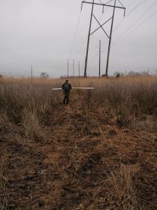
After the project was completed, the DNERR was interested in understanding how wetlands naturally recover over time without human interference. Since the DNERR has an established protocol for monitoring wetland plants, this protocol was used to begin a monitoring project in the construction area.

Photo documentation was added to the monitoring protocol to visually understand how landscapes change or recover. Some areas of the power line replacement monitoring project have changed to provide new habitats that didn’t exist before. For example, in areas that were heavily trafficked during the construction efforts, mudflats with dense wetland plants on the edges have created foraging habitat for marsh birds.
Another thing we learned is that areas where the wetland plants have recovered did not have many small streams or channels. Other areas that changed and have not recovered as quickly all had significant water flow in the construction areas.
Lesson learned: if there is a need for construction in the future, it might be a good idea to avoid or maneuver around streams or channels to minimize impacts to the wetland.

Although the DNERR has been monitoring this area for four years, there is still a lot of information that can be collected to understand how the marsh naturally recovers over time. It will be interesting to see how this area looks in the future, and that’s one of the fun parts about science!
For more information about this project, please contact Christina.Whiteman@delaware.gov.
Delaware's Governor
State Agencies
Elected Officials
General Assembly
Delaware Courts
State Employees
Cities & Towns
Delaware State Code
State Regulations
Business First Steps
Phone Directory
Locations Directory
Public Meetings
Voting & Elections
Transparency
Delaware Marketplace
Tax Center
Personal Income Tax
Privacy Policy
Weather & Travel
Contact Us
Corporations
Franchise Tax
Gross Receipts Tax
Withholding Tax
Delaware Topics
Help Center
Mobile Apps
E-mail / Text Alerts
Social Media

Built by the Government Information Center
©MMXVIII Delaware.gov

