Facebook Twitter Instagram YouTube

Written on: July 22nd, 2025 in Natural Resources
By Alison Stouffer, DNREC’s Wetland Monitoring and Assessment Program
Congratulations folks! You have made it to the fifth, and final, installment of the cross-country wetland road trip. I would be lying if I said this wasn’t a bittersweet moment. I am excited to explore what the Northeast United States has to offer, but sad to say goodbye to all the fictional memories we have made together and hours we have spent in the car. As always, you can read up on the previous one, two, three, and four excursions on our blog.
Encompassing both the Atlantic coastal plain and the Appalachian Highlands, the landscape ranges from low-lying, flat topography typically along the coastline to forested hills and mountains as you move inland. This mountain range helps contain moist air from the ocean over the region, contributing to ample rainfall. Unlike other regions visited during this trip, the Northeast is not known for any particular wetland type. The topography and climate vary from state to state and might contribute to this image. Whatever the case may be, the lack of information hinders my introduction writing; so, let’s jump right in!
Delaware
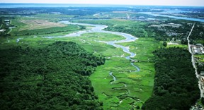
It seems only fair that we begin our final road-trip with the First State! Now, I will admit, picking one wetland point-of-interest for our home state was quite difficult when there are so many places to choose from. However, the road trip must go on; so, to Brandywine Creek State Park we go. This location was picked in order to highlight a rare wetland type in Delaware, seep wetlands. Seeps are small, non-tidal wetlands fed by groundwater that seeps out onto the surface or base of a slope. They provide significant local ecological value as they are Category One wetlands.
Maryland
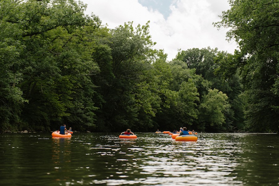
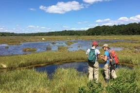
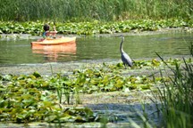
Our next stop takes us across the Chesapeake Bay to Jug Bay Wetland Sanctuary in Maryland. Located on the Patuxent River, the Sanctuary protects 1,700 acres of land across six properties. The Sanctuary encompasses freshwater wetlands such as tidal freshwater marshes – many of which are dominated by wild rice – and forested wetlands. As a sanctuary, Jug Bay balances the need for public recreation, scientific exploration, natural resource protection, and education to ensure maximum protection of wetlands. During your visit, enjoy the scenery, take a hike, view some birds, go for a paddle, or test your plant identification skills.
Pennsylvania
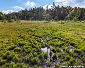
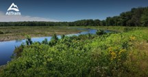
Moving north, we will be journeying to another freshwater wetland called Spruce Flats Bog in Forbes State Forest. This 28-acre wetland is unique in its elevation, having formed in a mountaintop depression. Not only is its elevation unique, but it has had quite the lifecycle! Spruce Flats Bog – over thousands of years – filled in, became meadowland, and then hemlock forest. The forest was then harvested around 1900, leaving the area to revert bag to a bog. Today, the bog continues to accumulate peat and fill with decaying plant matter, in the future returning to its meadow stage.
New Jersey
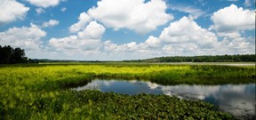
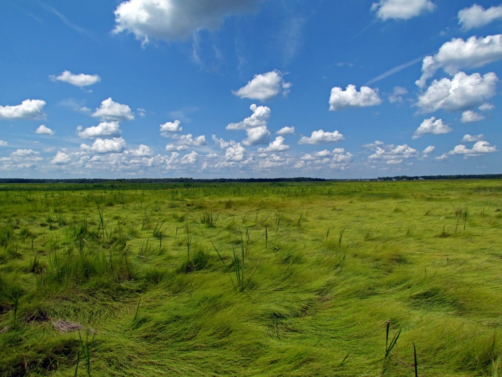
From freshwater to salt, our journey takes us to Edwin B. Forsythe National Wildlife Refuge. Spanning 48,000 acres, 82% of the refuge is wetlands, which act as a crucial stopover point for birds migrating along the Atlantic Flyway. Fun fact: the impoundment – a manmade structure that creates habitat for waterfowl and other birds through the control of water levels – seen today at the refuge was a historic railroad that cut through the marsh and was later destroyed by a storm and scrapped for metal during WWI and WWII. Along with birdwatching, visitors can experience the vast salt marshes of the refuge by foot, car, boat, or bicycle!
New York
Our next stop is a bit of a unique one as it was formerly the largest landfill in the world. Freshkills Park is a 2,200-acre park that is currently in development on Staten Island. Part of the plans include restoring 360 acres of tidal wetlands that had previously filled in to support development and a growing population. Before its time as a landfill, the area was home to the Lenape people, who relied on the wetlands for sustenance. After Dutch settlement, the land was then cultivated for salt hay, which fed horses transporting 17th century New Yorkers around the growing city. While pre-restoration scientific monitoring is currently taking place, visitors can kayak the Arthur Kill and connecting waterways that wind past and into the area, ultimately connecting to the William T. Davis Wildlife Refuge.
Connecticut
Continuing with the trend of tidal wetlands, we are headed north to the Connecticut National Estuary Research Reserve, which encompasses areas along the Connecticut River, Thames River, and Long Island Sound. Not only does the Reserve protect tidal saltwater and brackish wetlands, but it also includes submerged aquatic vegetation (SAV) and shellfish beds – which are important natural resources that go together with wetlands. For example, these habitats can provide a safe place for breeding and feeding, in turn supporting a diversity of fish species – so much so that the Connecticut River (with 78 species of fish) has the highest diversity in the region!
Rhode Island
A short distance to the east is Rhode Island, the smallest state in the country – it even has Delaware beat! Swamp wetlands are the most common types found within the state. Our next stop, the Great Swamp Management Area is an example of this type of wetland, and is even one of the largest contiguous swamps in Rhode Island. Managed by the State’s Department of Environmental Management, the area encompasses 2,200 acres of pristine cedar and red maple swampland.
Massachusetts
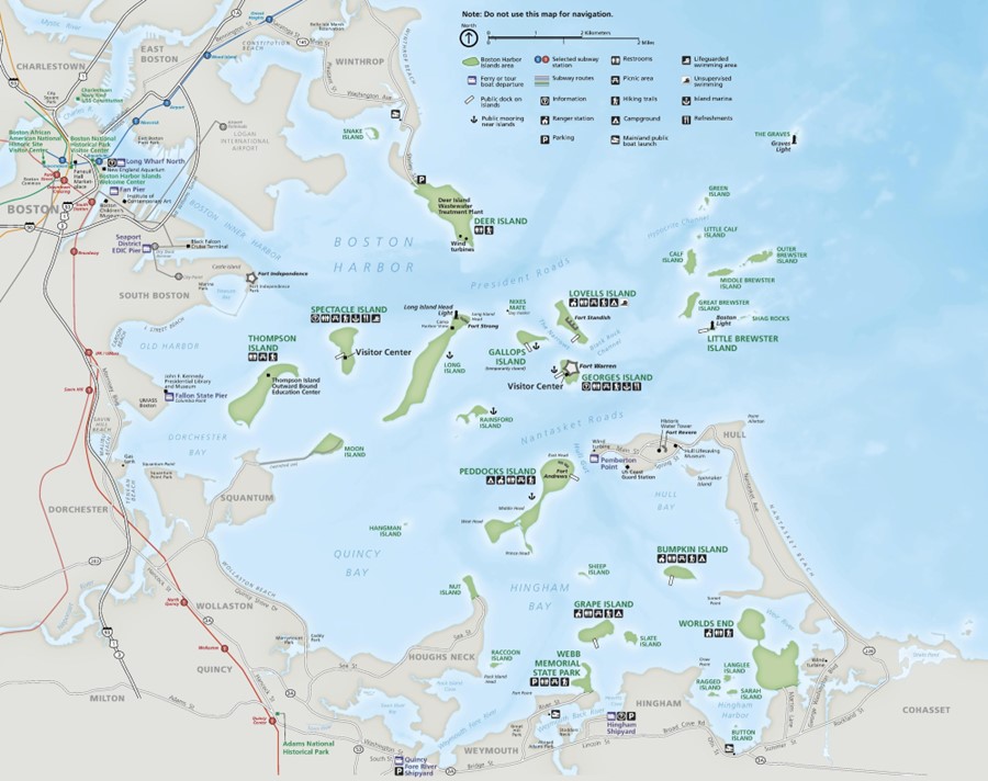
Our next wetland stop has us pahk the cah at the Boston Hahbah. From there, we will be taking a ferry ride to the 34 islands that make up the Boston Harbor Islands National Recreation Area. Each island is different and offers a unique wetland perspective. Some islands have marine intertidal and subtidal wetlands along their shorelines, which are exposed to the open ocean. Some islands have estuarine wetlands, which have some protection against the waves of the open ocean but experience tides from the Harbor. Finally, some islands have rare palustrine, or freshwater, wetlands. These are primarily seasonal vernal pools. Some islands even have any combination of these three wetland types.
Vermont
Like Delaware’s Category I wetlands, Vermont designates irreplaceable wetlands of exceptional ecological value as Class I wetlands, which is given the highest level of protection. While there are currently 11 designated Class I wetlands, we will be visiting The Nature Conservancy’s LaPlatte River Marsh Natural Area. This Class I wetland is a 205-acre floodplain of the LaPlatte River, filtering pollutants out of the water from the surrounding area before flowing into Lake Champlain. While enjoying the area – either by foot or by paddle craft – you will be able to see freshwater riverine wetlands, cattail marsh, black ash seepage swamp, and bottomland forested wetlands to name a few. If you’re lucky, you might spot a beaver gnawing on a tree, contributing to the wetland landscape. Explore more Class I wetlands here!
New Hampshire
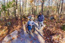
Like Vermont, our New Hampshire wetland stop is another property owned by The Nature Conservancy. We will be visiting the universally accessible Manchester Cedar Swamp Preserve. What do I mean by “universally accessible”? Well, let me tell you. TNC believes in equitable access to nature for all and has created a trail that is accessible to visitors with varying comfort levels and abilities. The trail and boardwalk are ADA-compliant, and interpretation is available in audio format in both English and Spanish. Visitors can view black gum and Atlantic white cedar trees – one of the rarest wetland types in the state – along with giant rhododendron right from the trail!
Maine
Last, but not least, we will be heading to a place I hold near-and-dear to my heart – it’s where I got my start in the field of wetland science – Rachel Carson National Wildlife Refuge. The Refuge consists of 11 parcels that protect important salt marsh ecosystems, among other types of habitats. This is especially important for the salt marsh sparrow, which relies exclusively on these habitats. Researchers at the Refuge focus on conserving and protecting critical habitat, managing and controlling invasive species, including Phragmites australis, piloting wetland restoration techniques, monitoring surface elevation and vegetation, and protecting threatened migratory birds like the piping plover.
Next Stop: The End
With that, we come to the sad end of our Cross-Country Wetland Road Trip. It has been a long journey we have traveled together over the months, but I know I have learned a lot about the different types of wetlands and what they look like state-to-state. I hope you have too. While my writing might have transported you to each and every location as if you were truly there (a girl can dream), be sure to consider making a stop if you do ever happen to be in the area of any of these wonderful wetlands! I know I will be. Until we meet again, enjoy Googling wetlands across the country, explore a local watering hole, and do your part to protect and promote these magnificent ecosystems.
Delaware's Governor
State Agencies
Elected Officials
General Assembly
Delaware Courts
State Employees
Cities & Towns
Delaware State Code
State Regulations
Business First Steps
Phone Directory
Locations Directory
Public Meetings
Voting & Elections
Transparency
Delaware Marketplace
Tax Center
Personal Income Tax
Privacy Policy
Weather & Travel
Contact Us
Corporations
Franchise Tax
Gross Receipts Tax
Withholding Tax
Delaware Topics
Help Center
Mobile Apps
E-mail / Text Alerts
Social Media

Built by the Government Information Center
©MMXVIII Delaware.gov

