Facebook Twitter Instagram YouTube
Written on: December 11th, 2024 in Education and Outreach, Natural Resources
By Jana Savini, Coastal Collaboration Coordinator, Partnership for the Delaware Estuary and RASCL Coordinator
The Delaware Resilient and Sustainable Communities League (RASCL) is a collaborative network of state agencies, nonprofits, and academic institutions that are dedicated to enhancing the resilience and sustainability of Delaware communities. By addressing climate challenges and capacity limitations, RASCL brings partners together, leverages limited resources, and coordinates efforts to empower local communities to implement effective, long-term resilience and sustainability initiatives.
RASCL serves as a hub for technical expertise and resources, uniting diverse partners under a shared vision of a resilient and sustainable Delaware. Through collaboration, RASCL addresses critical issues such as climate change, coastal resilience, sustainable land use planning, and resource management. Its outreach initiatives include free technical assistance, resource guides, information sharing, and community engagement, making RASCL a valuable resource for those navigating complex environmental challenges.

Who is RASCL?
The Resilient and Sustainable Communities League (RASCL) is an ad-hoc network of 28 member organizations. Its members represent diverse fields, including coastal resilience, natural resource management, energy, transportation, housing, emergency response, mental health, and outreach, among others. The network offers benefits beyond the capacity of individual organizations, such as programs tailored to support the practitioners, enhanced outreach efforts, and strategic networking opportunities. These efforts foster purposeful, mutually beneficial relationships that drive long-term success and sustained collaboration.
Key Initiatives
Project Guidance Group
The Project Guidance Group provides hands-on assistance to Delaware communities in planning and executing projects that enhance sustainability and resilience. Acting as a bridge between local communities and available resources, the group offers free technical support, information sharing, and connections to subject-matter experts. This collaborative approach ensures projects are effectively implemented and deliver lasting benefits to communities.
Developing a Community Sustainability Plan Resource Guide
To support local governments in creating sustainability plans, RASCL has developed a comprehensive guidance document. This resource serves as a framework for municipalities to craft strategies balancing environmental, social, and economic priorities. The guide emphasizes integrating sustainability and resilience, addressing potential climate impacts, and offering actionable steps. It is designed to be adaptable, empowering local leaders to tailor it to their unique needs and challenges.
Coffee Hours
RASCL Coffee Hours provide opportunities for information sharing and professional networking, fostering collaboration across diverse sectors. Held quarterly at various locations throughout the state, these events are offered both in-person and virtually to accommodate a wide audience. Each Coffee Hour features presentations that highlight best practices, emerging topics, innovative projects, funding opportunities, and more.
2025 RASCL Summit
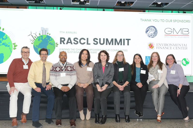
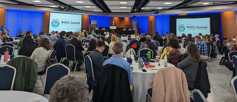
RASCL’s Annual Summit is a cornerstone event that convenes professionals, community members, government agencies, and elected officials to address critical issues impacting Delawareans. Serving as a platform for knowledge sharing, collaboration, and innovation, the summit promotes a unified and proactive approach to community resilience and sustainability. Attendees can explore best practices, gain insights from successful projects, and engage with experts on pressing climate change challenges.
The 8th Annual RASCL Summit will take place on Wednesday, March 5, 2025, at the Del-One Conference Center in Dover, DE. Registration information is available on their webpage.
Collaborative Impact
RASCL’s success is rooted in its extensive network of member organizations and community partners. These partnerships ensure that RASCL’s initiatives are informed by cutting-edge research, diverse perspectives, and practical expertise. By leveraging these collaborative relationships, RASCL delivers innovative solutions that address the unique needs of Delaware’s communities.
For more information about RASCL’s programs and resources, be sure to browse their website. Ready to get involved and find out more? Sign up for their mailing list!

Written on: December 10th, 2024 in Education and Outreach, Wetland Animals
By Olivia Allread, DNREC’s Wetland Monitoring and Assessment Program
Though pretending to be a National Geographic photographer is on our resumes, working in wetlands really does provide an exclusive opportunity to get up-close and personal with wildlife. Weather, soil, water, humans – many factors influence the presence of fauna in all wetland types. Each type of habitat can have specific, uniquely adapted species that call that wetland home, and some even exclusively depend on said wetland for their survival. As avid explorers of these ecosystems in Delaware, we’ve snapped some pretty interesting photos. Let’s browse through some of the weird and wonderous wildlife of wetlands.
Water Stick (Ranatra linearis)
At first glance, we thought this was plant debris until it moved. As an underwater predator, these insects not only camouflage well in their environments, but can ambush prey quickly. Water sticks adopt a mantis-like pose when submerged, capturing passing creatures like tadpoles, invertebrates, and small fish. This species uses its hooked front legs to catch food, while its tail acts like a snorkel above the water to siphon air for breathing. A crazy characteristic of this insect is that during hot summer days, adult water sticks often leave the pond to hunt in emergent vegetation or may fly to a new pond. Quite the journey for a small, slender bug.
Bryozoan
Meet this mysterious microscopic organism. A bryozoan, or zooid, grows no larger than 4 millimeters (5/32 of an inch) wide and forms colonies – like those pictured – that may contain thousands or millions of individual invertebrates. There are approximately 4,000 species in the phylum Bryozoa, and colonies come in many shapes and sizes. Species and colonies range from flat to folded, leaflike bushes to bouquets of sponges or flowers. Bryozoans lack any respiratory, excretory, or circulatory systems, but have a central nerve ganglion that allows them to respond to stimuli. As filter feeders, these creatures spend most of their life immobile, free floating or attaching to structures and vegetation underwater. Pretty neat for a big blob found in the Rehoboth Bay.
Eastern Tiger Salamander (Ambystoma tigrinum)
Large and in charge. At up to 12 inches long, the Eastern tiger salamander is the largest salamander in Delaware and is listed as endangered by DNREC’s Division of Fish and Wildlife. This amphibian spends most of its life in burrows below the upland forests of the coastal plain where they feed on snails, worms, and insects. When ready to breed in early spring, they emerge from the forest to migrate to vernal pools, or Delmarva Bays, one of Delaware’s unique wetland communities. The salamanders depend on these non-tidal wetlands for survival, using the pools to lay eggs on submerged vegetation and as a safe space for larvae to mature. Time is of the essence when researching or tracking the population in Delaware, as these crawlers only stay up to two weeks in vernal pools before heading back to their upland forested habitat.
Piebald Deer
We were happy our wildlife cameras spotted this one! Often mistaken for albino, piebald deer are few and far between in populations, with less than 2% of white-tailed deer having the genetic mutation. This recessive trait mutation causes varying amounts of white hair with brown patches or mostly white hair with very little brown patches on the animal. Not only are piebald deer highly visible to predators, but they are also often born with physical abnormalities such as shortened legs, deformed hooves, or arched spines. Currently in some states there are hunting restrictions and laws against harvesting these deer for sport or management purposes. Historically speaking, some Native American and Indigenous tribes believed these deer were spiritual or sacred and therefore not be hunted or bad luck to kill. All in all, seeing a piebald deer is a rare and beautiful sight.
Hellgrammite (Corydalus cornutus)
Here is something you don’t see every day. Featured here in its larval stage, the hellgrammite or Dobson fly, takes two names for the two distinct life stages it lives. As a larva, the macro-invertebrate spends up to three years in freshwater under rocks in swift moving water, using thick filaments as gills for breathing. During this larval stage, the aquatic insect is equipped with an impressive set of pincers, or mandibles, to catch and eat their prey such as small fish, other aquatic insect larvae, and tadpoles. After years of aquatic life, the hellgrammite larva enters full metamorphosis to emerge into a winged Dobson fly, only to live for a few days. And don’t worry, the pincers did not get us this time…
Glass Eel (Anguilla rostrata)
This little thing can go a long way. The American eel is a migratory species that spawns in the open waters of the Atlantic Ocean but spends its adult life within inland waters along our coasts. Born in the Sargasso Sea between the Caribbean and Bermuda, the juvenile eels will drift in the open ocean for months or more until currents carry them inland towards the nearest estuary or river (termed catadromous). During the early stages of their life they will metamorphose into a glass eel, shown here, as currents assist with migration transport into estuaries. Named for their transparent, glass-like appearance these little 2-inch wonders will make their way upstream in the late winter and early spring in search of freshwater or brackish habitats to grow in.
We use the term “weird” lightly here, as more of a hook to get folks reading and engaged about wetland wildlife they might not ever encounter or known existed. One of the most impactful ways of sharing knowledge about nature is through photography. It can be a form of conservation, helping raise awareness about a particular species or habitat. It can be considered an art form, capturing the beauty of living things aiding in the understanding of our delicate ecosystems. Diving into the wonders of the natural world in this way doesn’t require more than a cell phone and taking a good look at your surroundings. Working in wetlands is no easy task, so taking a quick photo is nice break from the mud and sweat, but even more worthwhile knowing it’s not just for our own camera roll.
Written on: December 10th, 2024 in Natural Resources
By Alison Stouffer, DNREC’s Wetland Monitoring and Assessment Program
The seasons are changing and while I wish we could stay in the warmth of the Southwest a little longer, our road trip will be taking us up north to the Midwest United States. For those of you joining us for the first time, we are slowly making our way across the country as we explore a new wetland in each state of the US. If you are feeling like you missed out, you can read up on the first and second excursions on our blog.
Falling between the Rocky and Appalachian Mountain ranges, this region of the country is characterized by low, flat, and rolling prairies. With wetlands covering over 50% of the region1, these states are known for the Great Lakes and their abundance of prairie potholes. Prairie potholes are non-tidal, freshwater, depressional wetlands created from historic glaciers that now provide essential habitat for migratory waterfowl2. We will explore these, and more, as we embark on our journey through the Midwest.
Kansas
Our first stop of the Midwest road trip takes us to central Kansas where we will be visiting the 41,000 acre wetland complex of Cheyenne Bottoms. Designated as a Wetland of International Importance, Cheyenne Bottoms is the largest freshwater marsh and inland wetland in the US! This wetland not only provides the public (us) with a great road trip stop but is also an important stopover for migratory birds along the Central Flyway.
Nebraska
A day’s drive north and we come to Agate Fossil Beds National Monument. At first glance, our destination seems to be dominated by prairie grasslands; however, the Niobrara River feeds a handful of wetland habitats. Within the river floodplain, you will find riparian areas, oxbow ponds, ephemeral streams, seeps, and springs. Due to the flat terrain, the river is often changing directions and meandering throughout the plains creating an ever-changing environment of wetland habitat.
South Dakota
Continuing north, we will be stopping next in South Dakota. Sand Lake National Wildlife Refuge encompasses an 11,450-acre prairie pothole lake, designated as a Wetland of International Importance. Managed by the US Fish & Wildlife Service, this refuge offers visitors a variety of activities including, hunting, wildlife viewing, birding, and hiking. If we are lucky, we may even see refuge scientists conducting vegetation and wildlife surveys to monitor wetland health!
North Dakota
Continuing our journey through the heart of the prairie pothole region, we will be visiting Tewaukon National Wildlife Refuge for our North Dakota wetland. This refuge is recognized for its importance to the Sisseton Wahpeton Oyate Tribe. Providing a bountiful location for native people to hunt and hold gatherings, the refuge was named after the Lake Traverse Reservation’s first leader TiWakan, which means “Sacred Lodge”.
Minnesota
At the meeting point of coniferous forest, deciduous forest, and grassland (prairie) lies Cedar Creek Ecosystem Science Reserve, a unique wetland point-of-interest at the convergence of three biomes (a rare occurrence). Each biome is the result of differences in moisture regime and temperature ranges. As such, different wetland habitats can occur within these biomes. For example, white cedar swamps and sphagnum tamarack bogs can be found in coniferous forests and wet meadows can be found in the grasslands at Cedar Creek.
Wisconsin
I hope you aren’t lactose intolerant because the next stop on our wetland road trip brings us to Wisconsin, the cheese state! Following in the footsteps of our Kansas and South Dakota points-of-interest, Horicon Marsh Wildlife Area and National Wildlife Refuge is recognized as a Wetland of International Importance and is one of the largest inland, freshwater marshes in the US at 33,000 acres. Like many other wetlands in the prairie pothole region, Horicon Marsh was created thousands of years ago by glacial deposits. Visitors can enjoy over 5 miles of hiking trails and/or six miles of paddling trails in and around the marsh habitat.
Iowa
For those looking for a more hands-on wetland education, our next wetland stop brings us to the Driftless Area Wetland Centre in northeast Iowa. This nature center connects people with nature and provides ample environmental programing including ADA accessible trails to prairie wetlands, guided wetland exploration with dip nets, and a variety of displays. Historically, this location was a booming rail yard turned industry dumping ground, which led to its classification as a brownfield site. Presently, the Driftless Area Wetland Centre showcases the successful restoration of a contaminant-laden railroad brownfield site to native wetlands.
Missouri
As we continue our loop around the Midwest, we come to Marmaton River Bottom Prairie Wetland Preserve in Missouri. The Preserve exists as the largest remaining tract of wet prairie in Missouri that is unplowed, providing the area with flood mitigation and erosion prevention. To help protect the land, The Nature Conservancy periodically implements prescribed burns to bolster the growth of native vegetation and prevent invasive species from taking over.
Illinois
Turning to the north again—and continuing the trend of visiting glacier-formed wetlands—we will be visiting Cranberry Slough Nature Preserve in Illinois. This 372-acre preserve was dedicated in 1965 as the 5th Illinois Nature Preserve for its unique peat bog ecosystem. Part of protecting Cranberry Slough includes the removal of invasive brush by means of prescribed fires and mowing, which allows native vegetation to move back in. These efforts have been highly successful.
Indiana
Our next stop is a particularly exciting one. Why? Because (insert Bon Jovi singing “Livin’ On a Prayer”) WE’RE HALFWAY THERE! That’s right folks, we have made it to our 25th wetland point-of-interest, Indiana Dunes National Park. Indiana Dunes encompasses 15,000-acres of a range of habitats along and inland from the coast of Lake Michigan. A wetland type of particular note is the interdunal, freshwater marshes. As glaciers from the last Ice Age slowly melted away, they left behind successive lake shorelines and dune structures, forming these marshes (also known as wet swales) within the depressions.
Michigan
From Lake Michigan in Indiana to the state of Michigan, we will be stopping next at Humbug Marsh. Situated along the Detroit River, Humbug Marsh stands as the last mile of natural coastline along the river, which connects Lake Huron and Lake Erie. The marsh was acquired by Trust for Public Land (TPL) and is now managed by the US Fish & Wildlife Service to protect the remaining wetlands from industrialization and development, which surrounds the marsh on either side. This preserve is on the smaller side at 405 acres but is important habitat among a developed landscape.
Ohio
From one river to the next, our final destination on the Midwestern wetlands tour is the Wilma H. Schiermeier Olentangy River Wetland Research Park. Run by Ohio State University, these created wetlands offer opportunities for outreach, education, and research to students and faculty of the college—and are even open to the public! Wetland habitats within the research park include two experimental wetlands, a created oxbow wetland, naturally occurring bottomland hardwood forest wetlands within the Olentangy River floodplain, and two stormwater retention ponds.

Next Stop: Wetlands of the Southeast
While not every wetland point-of-interest was formed from receding glaciers, it is clear the Midwest is known as the prairie pothole region for good reason! Even so, the wetlands we visited during this installment of our cross-country road trip all had something unique to offer. I am excited to bring you along next time to see what’s in store as we continue our journey to the wetlands of the Southeast. In the meantime, take a break from the road tripping to enjoy the holidays. See you soon!