Facebook Twitter Instagram YouTube

Written on: May 14th, 2019 in Wetland Assessments
By Alison Rogerson, DNREC’s Wetland Monitoring and Assessment Program
In 1998 the Delaware Department of Natural Resources and Environmental Control’s (DNREC) Environmental Scientist, Amy Jacobs (now with The Nature Conservancy), took part in a grant project held by the Delaware chapter of The Nature Conservancy and the Smithsonian Environmental Research Center. This project developed the science and comprehensive hydrogeomorphic models for freshwater wetlands in the Nanticoke River watershed and assessed water quality benefits of wetlands in varying condition. This was done to develop a wetland profile for wetlands in that watershed.
Then, in 1999 DNREC addressed the need to track not only the acreage of wetlands across Delaware and how that acreage is changing over time, but also examine the on-the-ground condition of wetlands. Measuring wetland condition compared to reference condition (the best and healthiest wetland you can find) gives a measure of how well wetlands are able to perform their natural functions and benefits.
Are our wetlands capable of trapping carbon, of intercepting and filtering pollutants from our surface waters, of holding stormwater and preventing flooding? These free benefits were underappreciated and not well tracked. If we can rate and track wetland condition as it relates to wetland function, we can grasp where wetlands are thriving and where they need work. Thus began the mission of the Wetland Monitoring and Assessment Program (WMAP)!
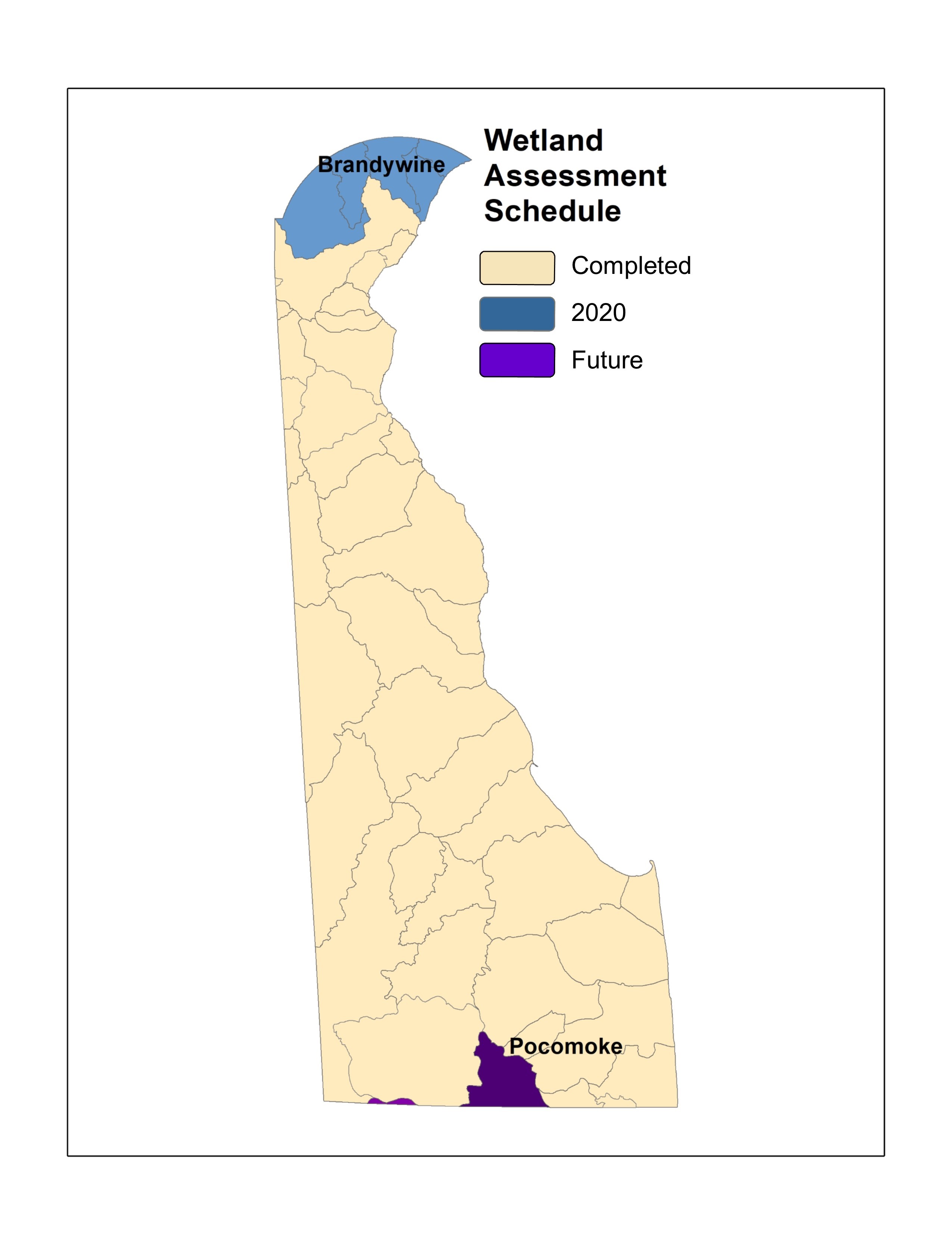
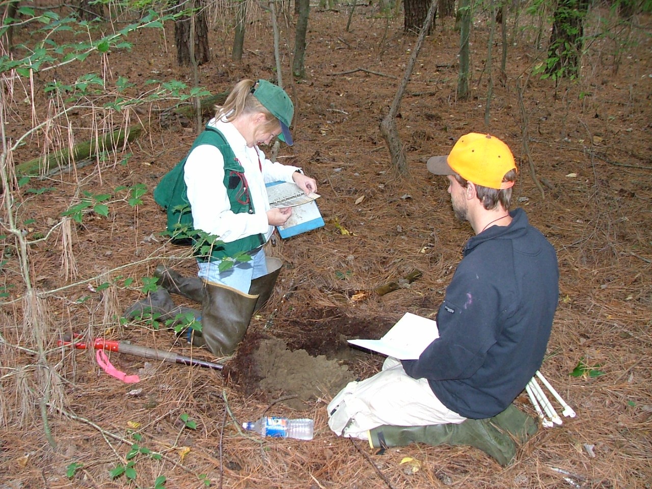
Since then we have been building and growing! Our program has (with some partner collaboration) created 4 standardized wetland assessment protocols that rate wetland health, function and features. Working watershed by watershed we have visited nearly every corner of Delaware on the ground (12 watersheds).
This summer we will be working in the Brandywine Creek watershed which leaves only the small Pocomoke River still to visit. Over that time we have visited and assessed 1,420 random wetland sites across the state. With the help of willing landowners we have been able to access public and privately owned wetlands, allowing us to accurately rate wetland health statewide.
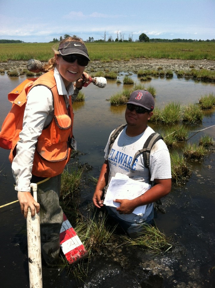
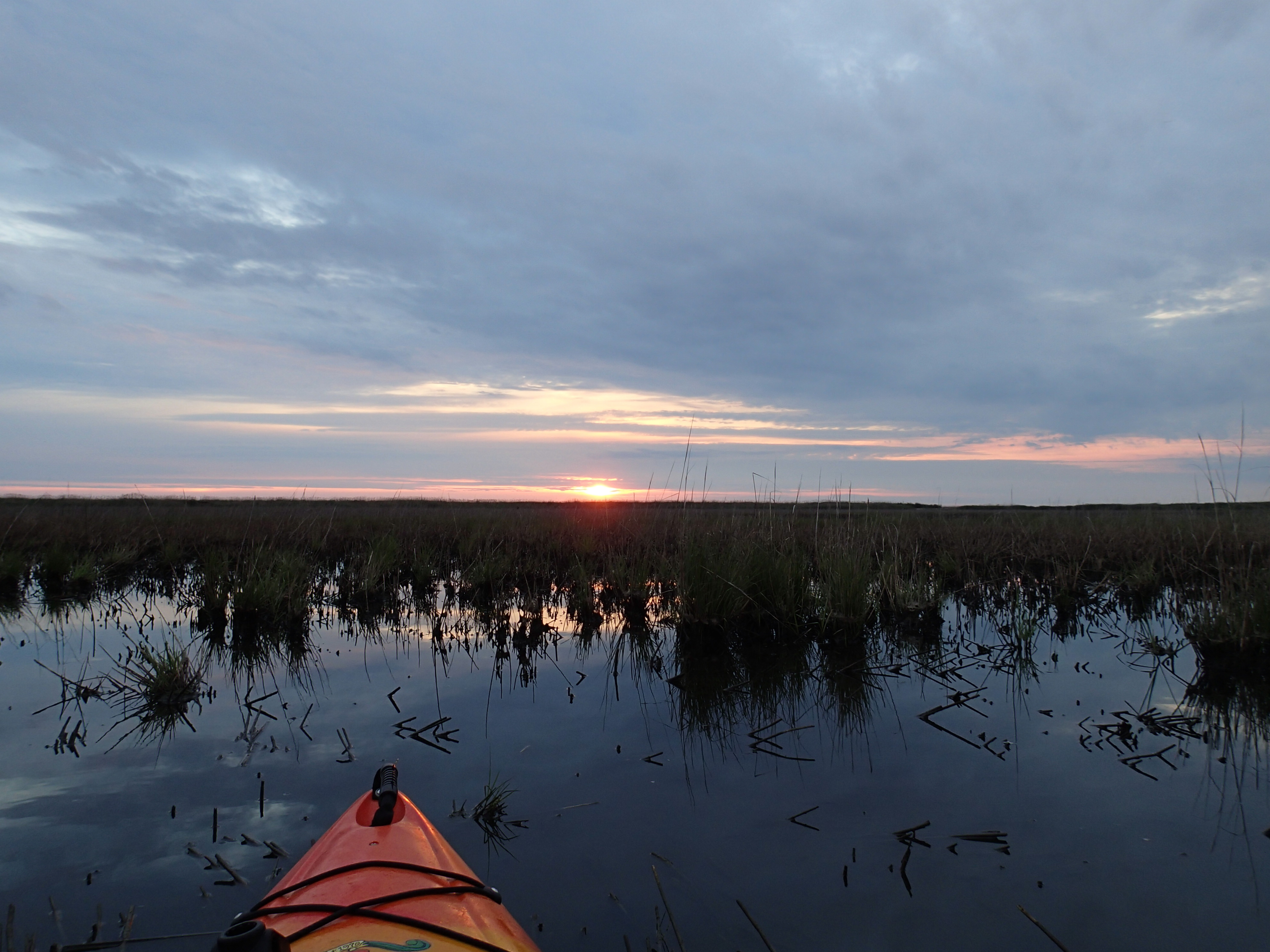
Along the way we met and worked with roughly 20 young professionals who joined us as seasonal wetland field technicians, assisting us during the busy summer season. Fieldwork is an adventure for everyone involved and we enjoy making memories and sharing our passion for wetland science with young minds.
It is so exciting the see how the Wetland Monitoring and Assessment Program has grown over the years. Growing out of a research study with The Nature Conservancy, Smithsonian Environmental Research Center, and Environmental Protection Agency, the program has held firm to using science as their foundation to improve management and educate a wide diversity of audiences. – Amy Jacobs, The Nature Conservancy, reflecting on where the program started two decades ago
Because unused data is wasted data we try our best to share our work and our information with the widest audience possible through every means we can. Over 20 years we have amassed thousands of photos, thousands of points of data and the most comprehensive tidal and non-tidal wetland condition dataset in the Mid-Atlantic Region.
Over the years we have gotten better at communicating wetland science and findings to an audience that isn’t always wetlands savvy. We’ve asked, we’ve survey and we’ve listened to what is important to Delawareans and how we can inform them to improve wetland protection and conservation.
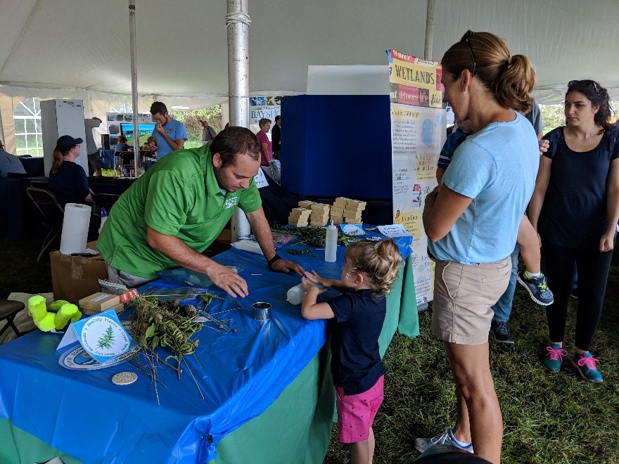
Our program has been extremely fortunate to receive funding that allows us to continually grow and develop our program, addressing new needs as they arise. In 2008 we added a team member to focus on outreach and education which enables us to share our projects and results with many audiences online and in-person. We continue to expand our audience every year and we now average 3,500 in-person interactions per year through presentations, workshops, and exhibiting at events.

As times change so have we to reach a wider audience. In 2011 we established a Delaware Wetlands Facebook page which has accrued 2,000 followers. In 2014 we started an Instagram account which now has 1,200 followers who get to enjoy pictures of our adventures and mishaps in the field. Additionally we decided to start making short educational videos, which are great for anyone teaching about wetlands. This really pushed us out of our comfort zone! We have now starred in 14 videos which have 44,000 views.
Over the course of our program our staff has given approximately 275 professional presentations to audiences around the country (and internationally too!).
But we didn’t stop at attending and presenting at conferences. We decided to convene wetland professionals of all types from around the state and eventually around the region for a Delaware Wetlands Conference. Held for the first time in October 2001 at Cape Henlopen State Park, the agenda focused on wetland status in Delaware, wildlife and habitat management, monitoring, restoration and permitting.
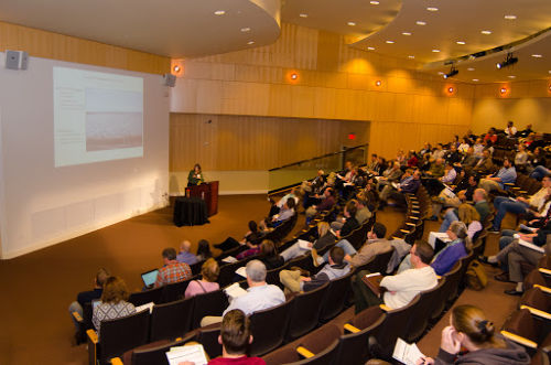
Over the years the conference moved to the Dover Sheraton Hotel to the Dover Downs and now the Chase Center on the Riverfront in Wilmington. What started as a one-day gathering of 100 has expanded to a two-day event for 350.
With 8 conferences on the books we are still striving to make the conference worthwhile and effective. Although it requires a year of planning, hosting the Delaware Wetlands Conference is extremely rewarding. To see so many sectors of professionals gathered together with a common interest in wetlands and a desire to learn and collaborate is inspiring. We look forward to the 2020 conference already!
We’ve accomplished a lot for such a small program, but we still have a lot to do. Another early member of the program Chris Bason, Executive Director for the Delaware Center for the Inland Bays gives the program kudos for its accomplishments but questions if the resulting scientific information is being heeded.
Wetland science in Delaware is very strong thanks in large part to the WMAP and the EPA’s and State’s continued investment in the Program… The question on the minds of those that have worked so hard to understand the importance and condition of these extraordinary natural resources remains: will Delaware’s political leadership be moved by the 20 years of science indicating these wetlands need protection? – Chris Bason, Delaware Center for the Inland Bays
For now we will focus on gathering relevant information and sharing our work with familiar and new audiences alike. For example, we are focusing on providing realtors and homebuyers with important information and tools to navigate buying and owning wetlands.
In addition, in 2019 we will be releasing 10-year updated statewide wetland maps and examining how and where wetland acres have changed in a decade.
Every year we continue to set higher goals for our program to reach a wider audience, interact with more citizens, tackle new issues, and push our limits in the name of wetland science and wetland conservation. Remember, you can find us on this blog, our social media accounts above, or main website anytime of day for wetland fun facts, photos, wetland research and data. See you around!
Delaware's Governor
State Agencies
Elected Officials
General Assembly
Delaware Courts
State Employees
Cities & Towns
Delaware State Code
State Regulations
Business First Steps
Phone Directory
Locations Directory
Public Meetings
Voting & Elections
Transparency
Delaware Marketplace
Tax Center
Personal Income Tax
Privacy Policy
Weather & Travel
Contact Us
Corporations
Franchise Tax
Gross Receipts Tax
Withholding Tax
Delaware Topics
Help Center
Mobile Apps
E-mail / Text Alerts
Social Media

Built by the Government Information Center
©MMXVIII Delaware.gov

