Facebook Twitter Instagram YouTube
Written on: July 17th, 2026 in Education and Outreach
By Olivia Allread, DNREC Wetland Monitoring and Assessment Program
When you think of South America, your head probably goes to the Amazon rainforest. The lush greenery, humidity in the air, species galore. Rightfully so, as it’s one of the most notorious ecosystems known. But just South of the Amazon, at the center of the continent, exists a place unlike many others; the Pantanal. And yes, you heard that right, it’s the world’s largest freshwater wetland. Spanning over three countries and roughly 43 million acres in size, this habitat is a beast. Not only is the Pantanal massive in size, but it’s one of the most biologically rich places on earth. This is for sure a bucket list visit, but we’ll take a blog post to hold us over for now.
Pantanal 101
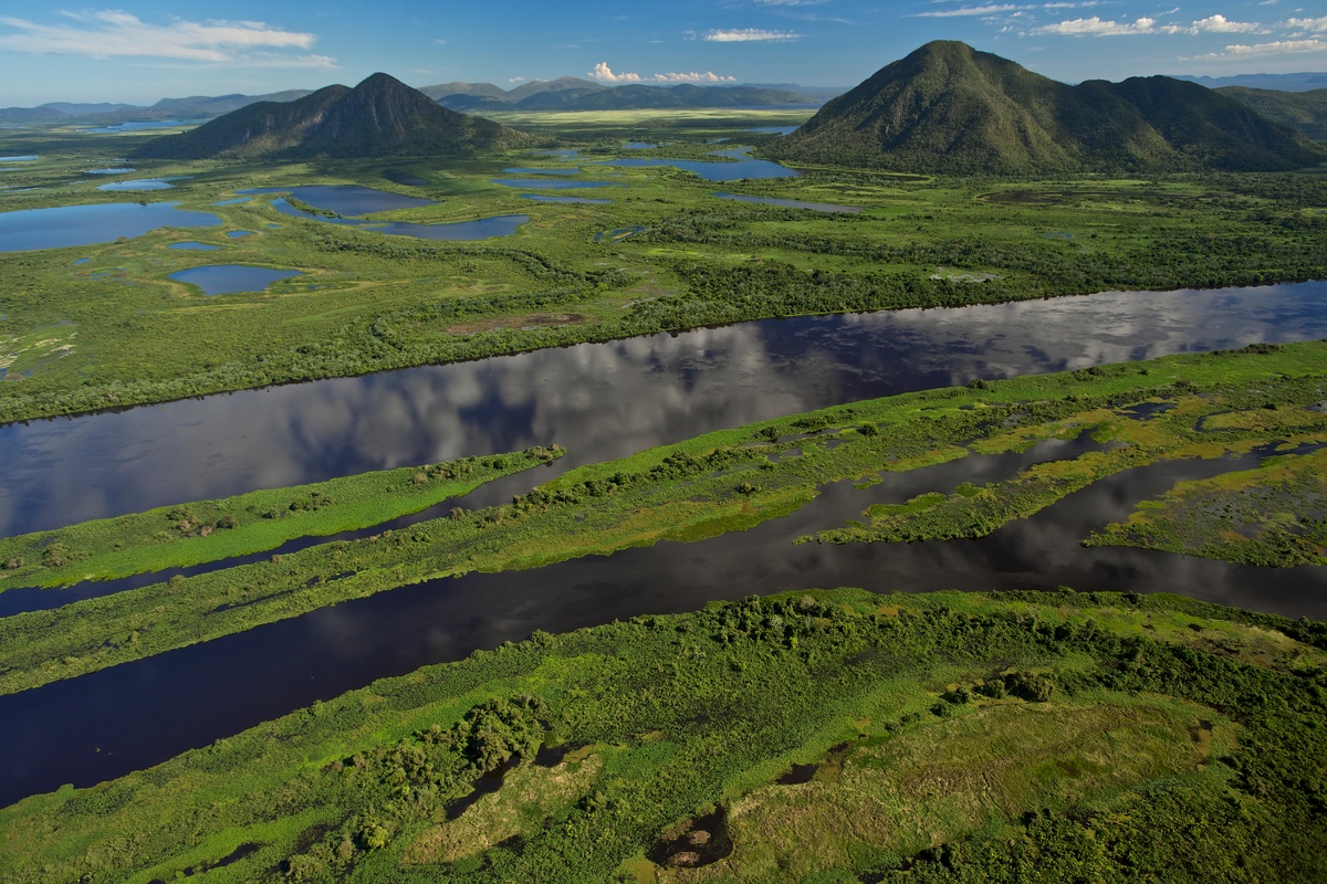
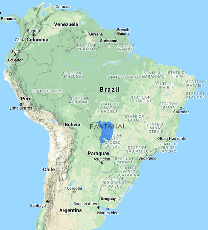
To better understand what we’re talking about, let’s get our eyes on the map below. The Pantanal is at the heart of South America and stretches over Brazil, Bolivia, and Paraguay, with about 80% of its area within Brazil. It’s 20 times larger than the Florida Everglades and is roughly the size of Washington state – we said it was big! The Pantanal itself refers to one giant wetland system interconnected by distinct subregions or types of wetland habitats. Essentially, it is a massive seasonal floodplain.
During the wet season from October to March, rain and flood waters from the Paraguay River and its tributaries flow downstream to fill an expansive basin creating wetland areas. When the dry season comes from April to September, the wetlands slowly drain out as the lush growth period comes to an end. Though this water cycle sounds simple, it is a complex, integrated system that creates the largest floodplain in the world. Due to the seasonality of this area, the Pantanal is a mosaic of habitats including riparian wetlands on rivers and lakes, savannas, ephemeral forested waterways (vernal pools), and many flooded grasslands. Among its amazing features, it also is a UNESCO World Heritage site and houses several Ramsar Wetlands of International Importance.
Cultural Past and Present
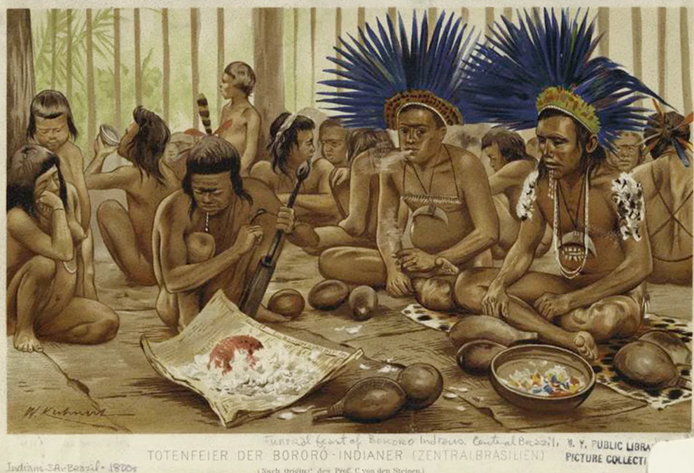
For thousands of years, Indigenous tribes like the Bororo, Guató, and Kadiwéu inhabited the Pantanal and lived a semi-nomadic lifestyle working in tandem with the wetlands. Think of them as the “OG” guardians of the area. Their spiritual and ecological relationship with the land and waters went undisturbed over centuries while the habitats remained intact, and more importantly functional. Into the 16th century, Spanish and Portuguese settlers sailed across the oceans to land in South America to hopefully find wealth and expand their European lands. The wealth part (aka gold and minerals) didn’t work out so well due to the presence of wetlands, so the settlers shifted their focus to farming and agriculture. The land part stuck as settlers conquered areas near and far, and as they say, the rest is history.
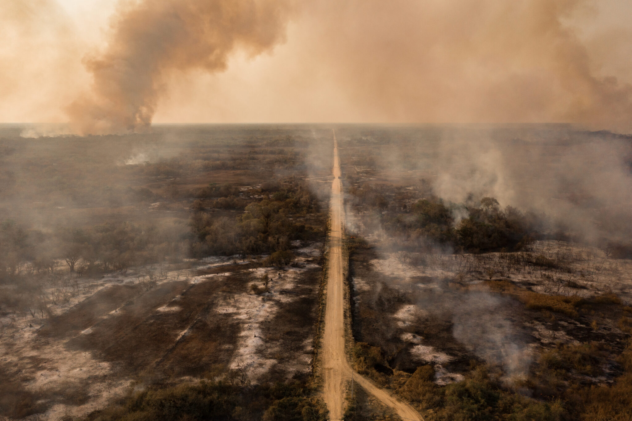
Particularly in the last 50 years, this dynamic area also has become a hotspot of geopolitical unrest. Wetlands across the Pantanal are intermeshed with territory conflicts and tensions between governmental powers, traditional agricultural, agribusiness exploiters, and environmentalists. On top of these issues, the impacts from climate change such as intense wildfires, drought, and rising temperatures are exacerbating frictions across the region as well as between neighboring countries – we’ll get into that a bit later.
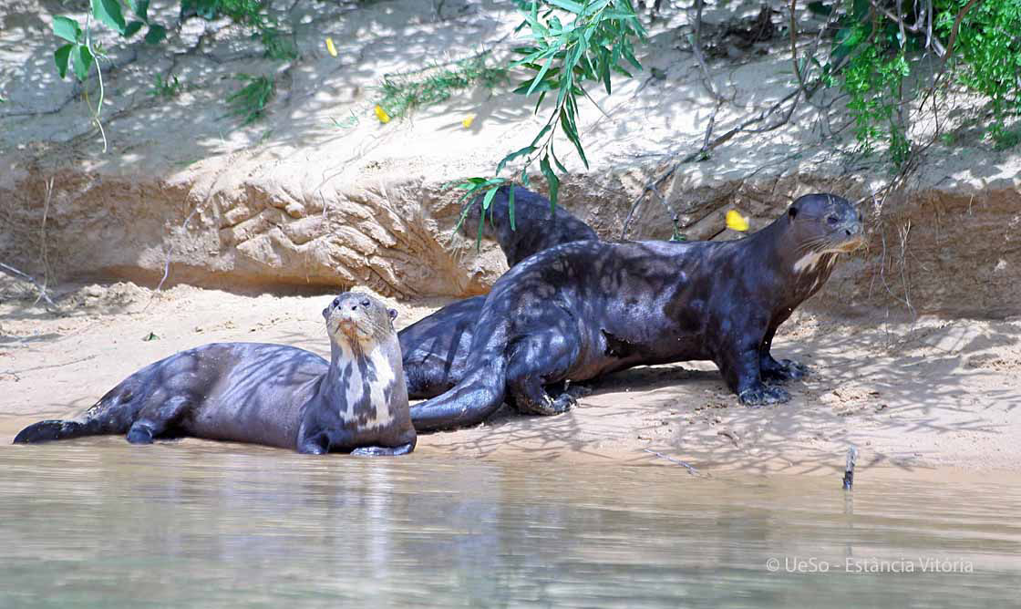
Astounding Species
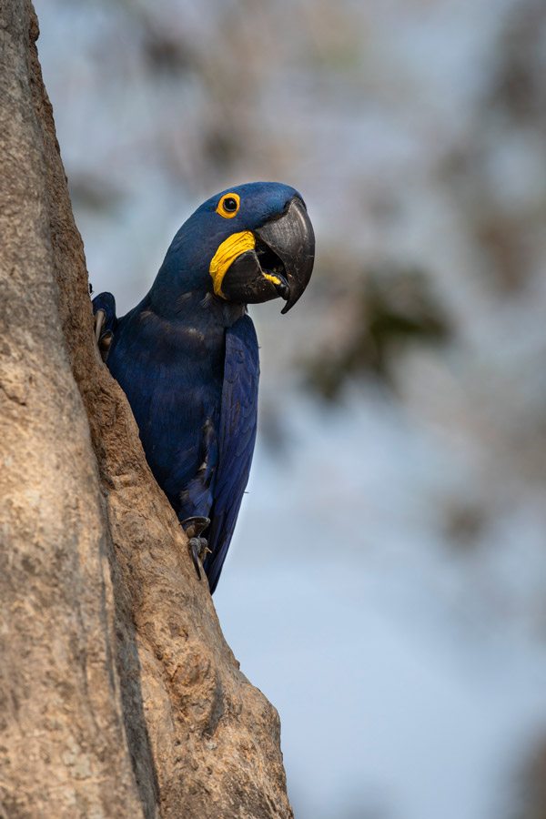
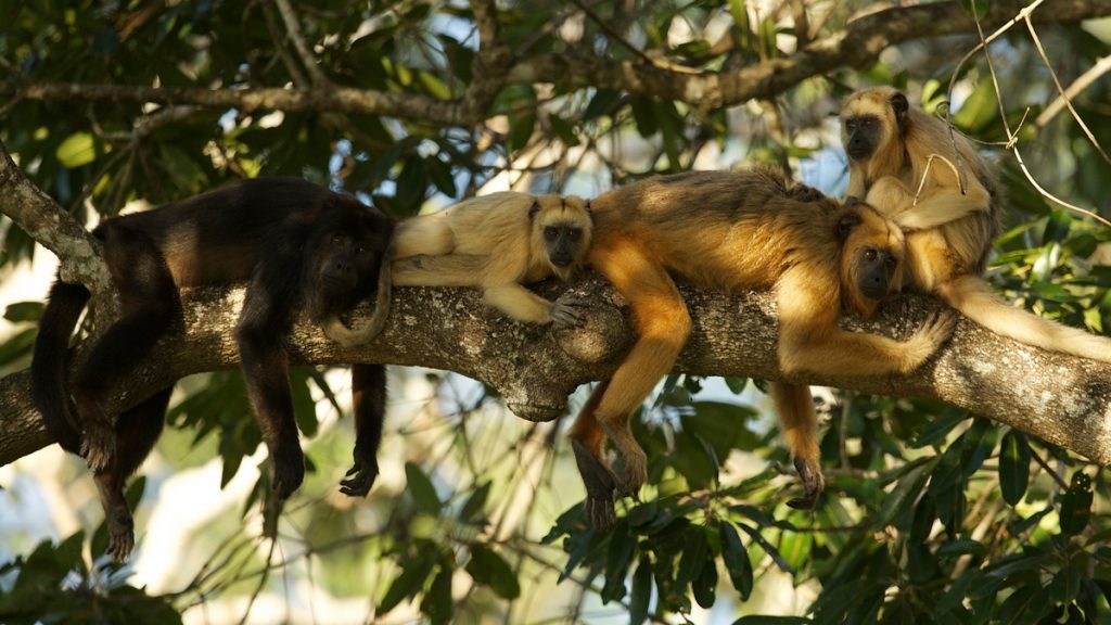
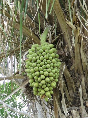
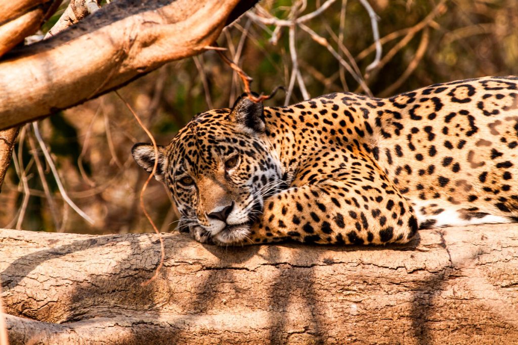
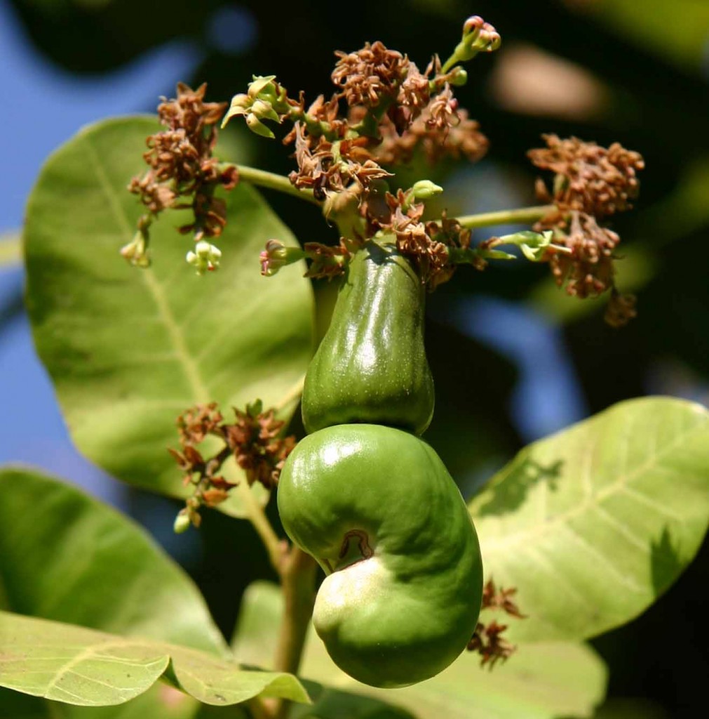
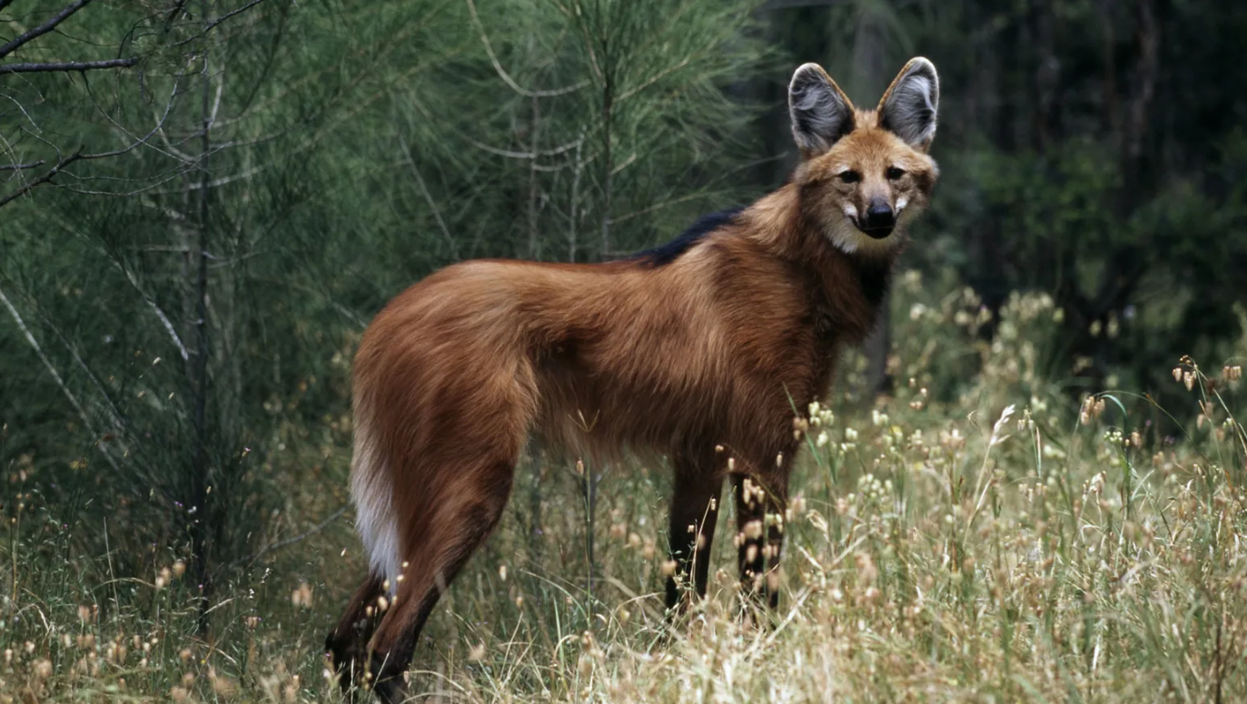
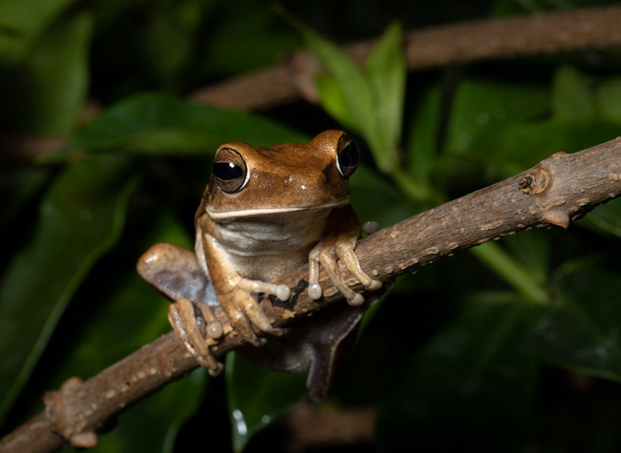
What the Pantanal is most infamously known for is its species of plants and animals. When we say rich in biodiversity, we mean it. More than 4,700 species of plants and animals call these wetlands home, some of which are steadily becoming at-risk or already endangered or threatened. We usually get into the nitty gritty of species inhabiting wetlands, but it was too hard to pick which ones to write about. So, we’ll let the photos speak for themselves.
Essential Ecosystem Services
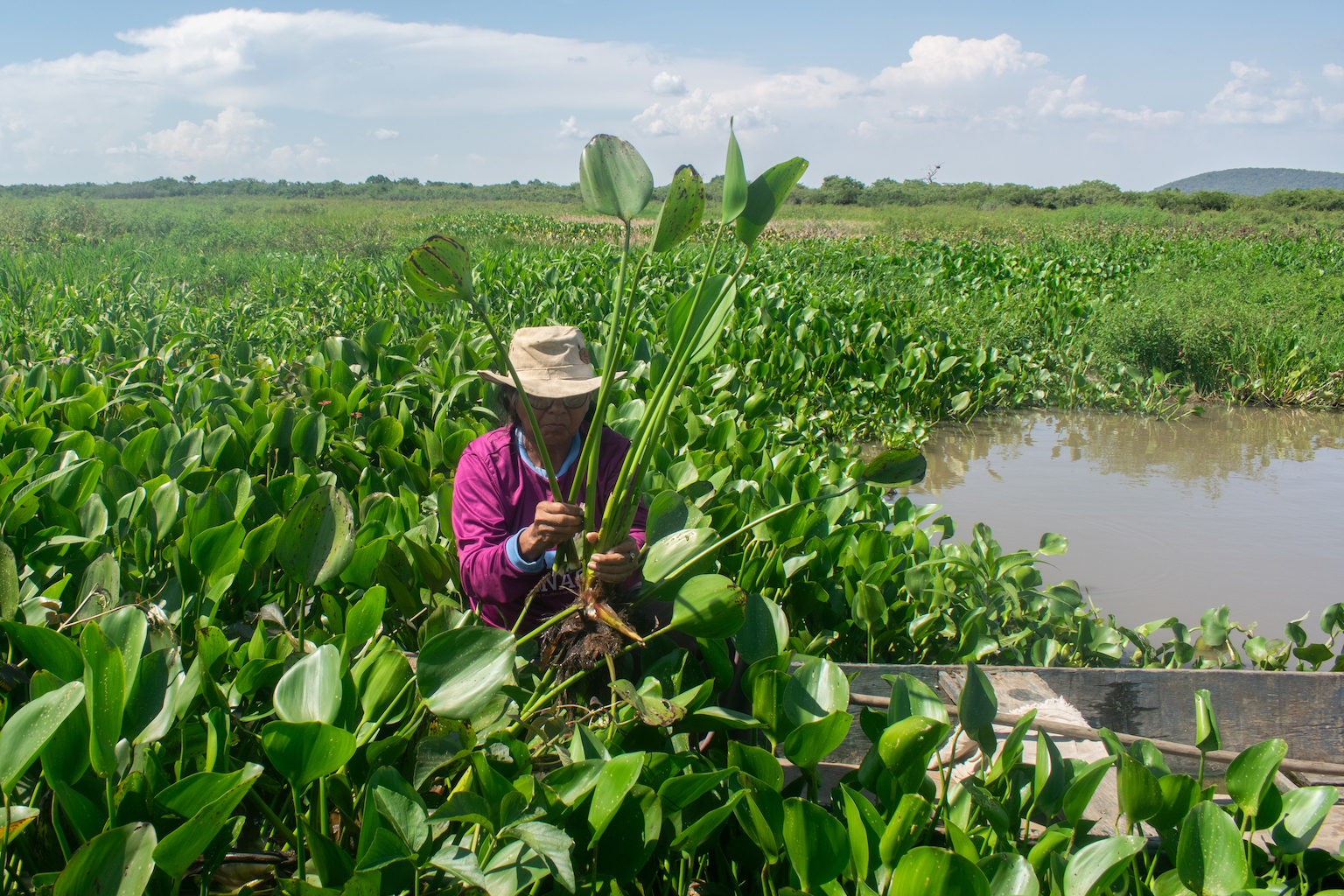
It’s not just flora and fauna that rely on these wetlands. More than 1.5 million people need the Pantanal for income, food security, and water supply, while another 8 million in the region depend on the expansive habitat for a variety of ecosystem services. The roughly 1,200 rivers and streams connected to the wetlands provide extensive recreational waters, but more importantly navigational channels for boats for travelling to work and for finding food. Many of the people who call this place home are dependent on the wetlands fluctuating waters as an asset for hydroelectricity, agriculture and farming, and drinking water. Located between the river basins of Paraguay and Cuiabá, this area plays a key role in everything from flood protection to maintaining fish stocks and groundwater recharge to healthy river flow. As part of the Corredor Azul, The Pantanal is an important source of water for the entire river system.
In terms of carbon storage, the Pantanal is a heavy hitter. Like peatlands, freshwater wetlands with vast forested areas in tropical regions are critical carbon sinks helping to mitigate climate change. Simply put, they store more carbon than they release and remove greenhouse gases from the earth’s atmosphere. A 2020 study shows that an estimated 37,587,200 metric tons (mT) of carbon would likely be released if the Pantanal wetlands were converted entirely to agriculture. Conversion into operations such row crops or CAFO’s have multiple negative impacts on the environment, one of them being that they release an immense amount of carbon into the atmosphere. Trust us, 37 million metric tons (mT) is a lot of carbon. With land conversion already a large threat to the region, these wetlands’ ability to naturally store greenhouse gases should always be considered.
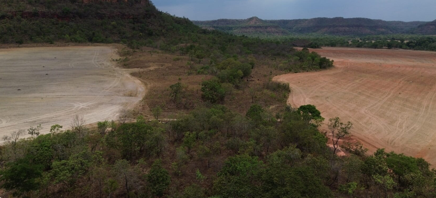
A Wetland Under Siege
As with many other wetlands across the globe, freshwater wetlands in particular, the Pantanal is under great threat. A lack of strong regulations and policies has created an environment ripe for exploitation and destruction. According to The Nature Conservancy, currently less than 5 % of the Pantanal’s wetlands are state or federally protected. That leaves a lot of decision making on the shoulders of private landowners, primarily cattle ranchers (also called fazendas), that make up the other 95% of ownership. Stronger legal protections could protect these wetlands from land conversion, lower the displacement of Indigenous communities, and help educate private landowners on sustainable practices. Another potential benefit from more wetland-focused policy and regulation is that it creates space for climate adaptation and mitigation practices. Beyond regulation, other prominent threats in this area include:
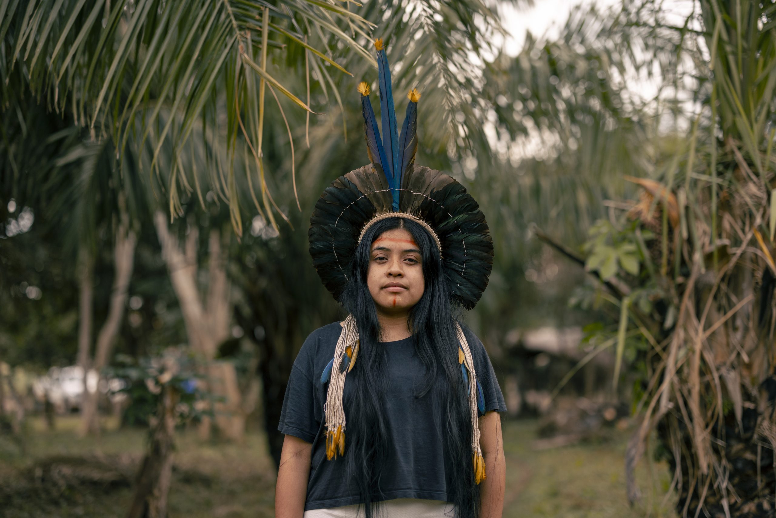
Among all the madness of modern times, the remaining Indigenous communities and Pantanal locals have come to the forefront of advocacy helping to protect both their people and their lands. Fighting fires, developing socioenvironmental projects, even becoming DJs who spread the word on vital work being carried out. As we speak, these local advocates are monitoring and reporting wrongdoings against humans and the environment alike, while telling their stories to inspire protection of the natural world.
While researching these wetland warriors, the word “harmony” came to mind. By overall definition, the word means a pleasing, balanced, and consistent arrangement of parts. It also describes a state of agreement, peace, and cooperation between elements whether that be between people, music, or ideas. The Pantanal wetlands truly are an arrangement of complimenting parts, an environment and its people living in ecological harmony. The local communities, the flora and fauna, the groups looking to exploit, the meandering waterways, the researchers who visit – they all have a role to play in balancing act of these wetland’s livelihood. This area is at a crossroads between survival and destruction; we are ones who can shape the future and help continue harmony with the world’s largest freshwater wetland.
Written on: July 17th, 2026 in Education and Outreach
By Lenore Tedesco, PhD, Executive Director of The Wetlands Institute Coastal wetlands are ecosystems and dynamic geomorphic features that help define much of the mid-Atlantic’s natural environment, especially across Delaware and New Jersey. They provide critical habitat and breeding grounds for marine life and coastal birds and protect the coastlines from storm waves and flooding. […]
Written on: May 26th, 2026 in Education and Outreach, Natural Resources
By Olivia Allread, DNREC’s Wetland Monitoring and Assessment Program Picture yourself walking through a forested freshwater wetland or a steamy tidal marsh. As you’re trudging through hues of fern, pickle, or chestnut, you see a light pink color in the distance. When getting closer, you see more of this stark color along stems, and boom […]
Written on: May 26th, 2026 in Education and Outreach, Wetland Animals
By Alison Stouffer, DNREC’s Wetland Monitoring and Assessment Program Take a moment to visualize a wetland scene. Imagine the plants that surround you. Imagine the water that is present. Now imagine the animals that might call this wetland home. Some of the animals you may have envisioned might include birds, muskrats, fish, and turtles – […]
Written on: March 23rd, 2026 in Natural Resources
By Alison Rogerson, DNREC’s Wetland Monitoring and Assessment Program After a long, snowy winter, it seems that spring is finally here. The longer days and springtime thaw gets many of us itching to get outside to work in the backyard. After months of looking out the window at last year’s brown remnants, we can’t wait […]
Written on: March 20th, 2026 in Education and Outreach, Wetland Research
By Olivia Allread, DNREC’s Wetland Monitoring and Assessment Program Deserts and water; the two don’t go together. Low precipitation, high evaporation rates, sandy soil, rain shadow effect – there are many factors that affect the lack of water in a desert environment. But across the American Southwest and into Northern Mexico lies a habitat that […]
Written on: March 20th, 2026 in Education and Outreach, Natural Resources
By Tyler Dreiblatt, DNREC’s Division of Parks and Recreation We humans often have a hard time understanding the value of our natural resources. Unless something is pretty or has an obvious use, we tend to ignore it. Take the salt marshes surrounding Burton Island. Once dismissed as a dirty breeding ground for mosquitos, they are […]
Written on: December 22nd, 2025 in Education and Outreach, Natural Resources
By Olivia Allread, DNREC’s Wetland Monitoring and Assessment Program Sanctuary. All seek it, some search, and a lucky few can find it. As we know, these “sacred” spaces can come in many different forms and represent an untouched meaningfulness which is irreplaceable. One of a kind so to speak. At the far end of the […]
Written on: December 22nd, 2025 in Wetland Animals
By Alison Stouffer, DNREC’s Wetland Monitoring and Assessment Program If you are like me, you have likely been driving down a rural road, paddling through a tidal wetland, or going for a stroll through a state park and seen a furry, brown animal that had you doing a double take. That wasn’t a weird looking […]
Written on: September 24th, 2025 in Natural Resources, Wetland Research
By Alison Rogerson, DNREC’s Wetland Monitoring and Assessment Program Introducing Tidal Freshwater Most people are familiar with tidal wetlands that line the Delaware Bay coast and the Inland Bays. Likewise, most of us can recognize a freshwater wetland along a stream or in a forest. But what about tidal freshwater wetlands? That’s not a typo. […]
Delaware's Governor
State Agencies
Elected Officials
General Assembly
Delaware Courts
State Employees
Cities & Towns
Delaware State Code
State Regulations
Business First Steps
Phone Directory
Locations Directory
Public Meetings
Voting & Elections
Transparency
Delaware Marketplace
Tax Center
Personal Income Tax
Privacy Policy
Weather & Travel
Contact Us
Corporations
Franchise Tax
Gross Receipts Tax
Withholding Tax
Delaware Topics
Help Center
Mobile Apps
E-mail / Text Alerts
Social Media

Built by the Government Information Center
©MMXVIII Delaware.gov

