Facebook Twitter Instagram YouTube RSS Feed
Written on: May 8th, 2019 in Wetland Animals
by Erin Dorset, Wetland Monitoring & Assessment Program
Birding is always exciting in Delaware. While some bird species are year-round residents, many others are migrants traveling along the Atlantic Flyway. This keeps things interesting, as it allows birders to see a very wide variety of species throughout the year. A lot of these awesome birds exist in or near wetlands in Delaware, which makes wetland habitats great places to go birding!
Here are some of the best sites to see birds in wetlands in Delaware (though this is not an all-inclusive list). For each place, we describe location, wetland habitat types, and how to get around. This will hopefully help you find the best locations that suite your birding interests!
Location: Smyrna
Wetland habitat types: tidal marshes, impoundments, mudflats
Description: This large refuge is probably the most well-known birding spot in the state. While there are some short walking trails and some observation towers at Bombay Hook, most of the refuge can be explored along a 12-mile driving loop. There are many places to pull off of the driving loop to look for birds in the wetlands.
Additional info: Click here to learn more about birding at Bombay Hook and see the map of the refuge. Also, view the refuge bird checklist for more details about what time of year you are likely to see different species.
Location: Milton
Wetland habitat types: tidal marshes, impoundments, mudflats, forested wetlands
Description: Prime Hook is another large federal refuge that can be explored on walking trails, by driving, or by a canoe trail. It is the site of a large restoration project that was designed to rebuild degraded tidal wetlands, which means that birds should benefit from the project!
Additional info: Check out the refuge map. Also see the bird checklist for more details about what time of year you are likely to see different species.
Location: Dover
Wetland habitat types: tidal marshes, impoundments, mudflats
Description: This is a state wildlife area that is made up of several tracts of land.
There are several parking lots and boat ramps, most of which require you to have a Conservation Access Pass (CAP). While there aren’t any designated walking trails, you can stop along roadsides, or view birds from a boat or a wildlife viewing tower. Note that hunting is permitted here.
Additional info: Check out the map of the wildlife area.
Location: Lewes
Wetland habitat types: tidal marshes, impoundments, mudflats, forested wetlands
Description: This state park has many hiking and walking/biking trails throughout many habitat types. Some go through maritime forest and dunes, and others pass by tidal marshes and a large impoundment (Gordons Pond). There is also a nature center at Cape Henlopen, where you can watch a live osprey camera! Plus, volunteers can participate in a hawk watch every spring and fall here.
Additional info: Look at the map of the state park, and check out the park’s birding checklist.
Location: Townsend
Wetland habitat types: forested wetlands
Description: Blackbird State Forest is quite large; it is made up of 9 tracts of land with about 40 miles of trails. This means there are great opportunities to find birds in and around the forest’s freshwater wetlands! Be aware that hunting is permitted within the forest.
Additional info: See the maps of the state forest tracts
Location: Bear
Wetland habitat types: forested wetlands
Description: The Swamp Forest trail goes around Lums Pond and through patches of forested wetlands for over 6 miles, providing a great opportunity to see birds that are associated with wooded wetlands! There are also several other trails and a nature center to enjoy.
Additional info: View the map of the state park
Location: Frankford
Wetland habitat types: tidal marshes, mudflats, impoundments, forested wetlands
Description: This is a state wildlife area that is made up of several tracts of land.
It has several parking lots and boat ramps, most of which require you to have a Conservation Access Pass (CAP). While there aren’t any designated walking trails, you can stop along roadsides, or participate in the auto tour. You can also view birds from a boat or a wildlife viewing tower. Note that hunting is permitted here.
Additional info: See maps of the wildlife area tracts
To learn about some more great birding locations in Delaware, including places with non-wetland habitats, see the Delaware Birding Trail.
While these are not all-inclusive lists—and some birds may cross over from one habitat type to another– here are some of the bird species that you might encounter in different wetland habitats in Delaware.
Clapper rail; Virginia rail; Marsh wren; Seaside sparrow; Saltmarsh sparrow; Great blue heron; Snowy egret; Great egret; Willet; Least bittern; Northern harrier; Osprey; Common moorhen; Sora; Glossy ibis; Forster’s tern
Semipalmated sandpiper; Least sandpiper; Sanderling; Semipalmated plover; Greater yellowlegs; Lesser yellowlegs; Black-necked stilt; Ruddy turnstone; Dunlin; Short-billed dowitcher; Red knot; Willet
Mallard; Northern shoveler; Green-winged teal; Blue-winged teal; Northern pintail; Gadwall; Bufflehead; Canada goose; Tundra swan; Snow goose; American black duck; Ruddy duck; Black-crowned night heron; Yellow-crowned night heron; Green heron; Great blue heron; Common moorhen; Least bittern; Red-winged blackbird; American avocet
Wood duck; Cerulean warbler; Louisiana waterthrush; Warbling vireo; Yellow-throated vireo; Prothonotary warbler; Kentucky warbler; Yellow-throated warbler; Barred owl; Eastern screech owl; Great-horned owl; Wood thrush; Northern flicker; Downy woodpecker; Red-bellied woodpecker; American woodcock
Written on: March 11th, 2019 in Outreach
by Brittany Haywood, DNREC Wetland Monitoring and Assessment Program
One part of our job is going out into the public and explaining simply our research and the benefits of wetlands. We often use the saying, “wetlands are like sponges” to describe their ability to absorb water, but recently we’ve been asked exactly how that is so.
Describing wetlands as sponges dates back all the way to 1784 where Nicholas Turner described peat wetlands as, “in the nature of a sponge; for if a dry piece is put in water it will absorb double its weight” (Turner, 1757 p40). Since then this metaphor has been used all over the world to describe one of the many benefits that wetlands provide.
For this blog post we will explore the two linked concepts: one, how do sponges work, and two, how wetlands absorb water. Then, we will package it all up with a nice neat bow to make the connection that will hopefully satisfy all you knowledge seekers out there.
When you put a sponge in water, it absorbs it. This happens because the bubble like spaces inside the sponge have the ability to hold water and the sponge material locks it in. Water won’t be released until someone forces it out through squeezing or it could be allowed to dry out over time.
Also, have you ever noticed that it’s easier for a damp sponge to soak up water than a completely dry one? That’s because water is extremely sticky, and it sticks better to itself than anything else.
Nerdly speaking, water is a molecule made up of two hydrogen atoms and one oxygen atom. These molecules really like to form hydrogen bonds with each other, i.e. water loves to stick to itself. This is called cohesion. Water will also stick to other objects, like the dry sponge or soil, but it doesn’t do it quite as well. This is called adhesion. (Exploring Our Fluid Earth, 2019)
Wetlands are made up of wet soils, water loving plants, and of course, water. Soils have lots of spaces in between the soil particles called soil pores. And like the setup of the sponge, they can hold and trap water. How much water they hold onto depends on the pores sizes and soil type. Clay soils have small pores and trap water very well whereas sandy soils have larger pores allowing water to move more freely through it. Also these mineral type soils tend to attract water because of their unsatisfied ionic charge. (Nelson, 2015)
Wetland plants also play an important role in water absorption. These plants are specifically adapted to live in watery places. They absorb water and use what’s in it to grow. So not only do wetlands have water storage capabilities in their soils, they have it in their plants.
Water in wetlands is either released naturally and slowly over time to groundwater supplies, streams, or it evaporates. It can also be physically forced out by someone or something draining it.
As you have read above, water sticks to water better than dry objects so it would make sense that in order for a wetland to do its job, it needs to be wet. So draining wetlands may not be the best idea if you want to have a good functioning wetland.
So the long and short of it is both sponges and wetlands:
But wait, you’re probably thinking if wetlands absorb water, do they have a limit as to what they can hold?
Yes they do! Just like sponges, wetlands have a carrying capacity. So when the wetland becomes full you will see more pooling surface water, especially recently with all this rain we’ve been having in Delaware.
Now that you know how wetlands absorb and hold water, just think about how much more H2O you would see on our land surfaces if wetlands weren’t there or if a wetland’s soil pores got clogged up from super dirty water…
Exploring Our Fluid Earth. (n.d.). Hydrogen Bonds Make Water Sticky. Retrieved from https://manoa.hawaii.edu/exploringourfluidearth/chemical/properties-water/hydrogen-bonds-make-water-sticky
Nelson, S. A. (2015, November 11). Groundwater. Retrieved February 27, 2019, from https://www.tulane.edu/~sanelson/eens1110/groundwater.htm
Turner, Nicholas. An essay on draining and improving peat bogs; in which their nature and properties are fully considered. By Mr. Nicholas Turner, of Bignor, Sussex. London, MDCCLXXXIV. [1784]. Eighteenth Century Collections Online. Gale. CIC Penn State University. 25 Feb. 2019. <http://find.galegroup.com.ezaccess.libraries.psu.edu/ecco/infomark.do?&source=gale&prodId=ECCO&userGroupName=psucic&tabID=T001&docId=CW108495006&type=multipage&contentSet=ECCOArticles&version=1.0&docLevel=FASCIMILE>.
Written on: March 11th, 2019 in Wetland Restorations
Guest writer: Jules Bruck, University of Delaware
Great things come naturally in Laurel, Delaware including the new green infrastructure treatments that are popping up along the Broad Creek – home to the future Laurel Ramble.
This past summer the Sussex County Conservation District broke ground on a parcel of land in the center of the Ramble plan called Tidewater Park. The project, designed to improve water quality in the area, was engineered by ForeSite Associates of New Castle, DE.
Work began on two treatments – a vegetated bioswale and a constructed wetland, in early summer 2018.
The bioswale was selected as a priority treatment due to the following factors:
The 300’ long gently meandering bioswale forms a diversion for runoff, permitting easier installation of the constructed wetland and fish habitat. It creates a viable, ecologically appropriate solution to aid in reducing pollutant loads to Broad Creek, which in turn makes a significant step forward toward meeting the demands of the town’s Municipal Separate Storm Sewer System (MS4) permit.
The bioswale represents a permanent change in drainage patterns on site, and it is expected to be a long-lived treatment as long as the inlet is regularly inspected and maintained. It’s designed to meet the total maximum daily load (TMDL) requirements for 2.23 acres of existing impervious surface in the drainage area.
The constructed wetland is approximately one acre is size, and planted with native grasses and sedges as well as some flowering herbaceous plants. It was designed to accept some stormwater surface flow from the upland areas as well as to allow the waters of the Broad Creek to enter during high tides.
According to the Stormwater Management Report prepared by FA in July 2016, “In keeping with the theme of the proposed playground as a nature-based feature and the Town’s goal to promote Laurel’s ecotourism industry, a tidal fish cell has been designed adjacent to the constructed wetland.”
“This tidal cell does not serve a regulatory function other than convey discharges from the constructed wetland to Broad Creek. Overflow from the constructed wetland is designed to discharge through a narrow v-shaped notch in the weir wall to help detain and slowly release runoff to the tidal fish area.”
The new landscape has diverse plantings that will increase the native biodiversity on site and attract wildlife such as ducks and butterflies. We look forward to the spring so we can evaluate how the plants survived over the winter.
We anticipate the wetland will become important habitat for spawning fish, such as American Shad. In fact, we had to be careful about working in the water during the summer to avoid disruptions during critical times for the local native fish.
After some minor touch ups and replanting of the plants that did not make it through the winter, the treatment should be relatively easy to maintain.
University of Delaware landscape architecture students worked on a landscape management plan under the direction of Dr. Jules Bruck thanks to funding from UD Community Engagement Scholars and DE Sea Grant. We continue to work with the Town of Laurel to develop a management plan.
We also want to keep an eye out for any invasive plants and provide training for the town’s landscape crews to help them identify and control non-native plants and noxious weeds. To that end, we’ve asked Tracy Wootten of Cooperative Extension to lend us a hand!
We are working on some ideas to engage facilities and the community so the project remains a benefit to all.
The Tidewater Park plan is a different type of landscape and you’ll start to see more of it as the Ramble plan is installed. It’s not just ornamental, it’s a working landscape.
This project was funded through two grants – the DNREC Community Water Quality Improvement Grant and the DNREC Chesapeake Bay Implementation Grant Program. Interested in learning more about this wetland and bioswale creation or the Laurel Ramble? Visit the Reimagining Laurel website. http://www.reimaginelaurel.net/
Written on: February 27th, 2019 in Outreach
by Brittany Haywood, DNREC Wetland Monitoring & Assessment Program
Wetlands are a part of our everyday lives. They are in the landscape silently helping to control flood waters, clean our drinking waters and protect us from damaging storms.
Knowing what wetlands are, where they are, how they work, and what can and can’t be done with them before property is purchased can save time and money in the long run. Read on to start your journey into Delaware’s wetland world.
The first and easiest way to figure out if wetlands might be on a property is to look at maps. There are two different wetland map types available for anyone to use for free online. Each serves a different purpose. If there is an area on a property that seems like it should be a wetland, but it is not showing up on a map, you should probably have a wetland delineation performed.
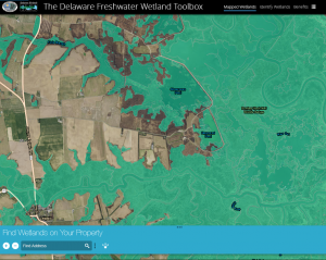
These maps outline all wetlands using the biological definition of wetlands: wetlands must have water on the surface for some part of the year, hydric soils and hydrophytic plants.
They map all wetland types including tidal and non-tidal wetlands, and serve only as a guidance tool. If a definitive wetland boundary needs to be determined, a wetland delineation is needed. Remember only certain wetland types are regulated, and just because a wetland is mapped, does not mean it is regulated. Click on one of the two maps below to get started:
The State of Delaware has the authority to regulate activities in tidal wetlands. Regulated wetlands are maintained at the Federal, state and county levels. These regulatory maps can help determine if there are State of Delaware regulated tidal wetlands on a property. If a landowner wants to know the location of State of Delaware jurisdictional features or believes the map to be incorrect, a Jurisdictional Determination and Map Change Request can be made.
A wetland delineation is a legal determination of a wetland boundary. An environmental consultant is hired to go onto a property and thoroughly document the existence of water, species of plants, and soil conditions to determine if a wetland is present and then flag its outer boundaries. These delineations can be used to see if a wetland permit is needed.
A wetland map is created through a computer analysis of environmental data and aerial images, and is followed up with on the ground verification of a select number of field sites. In the State of Delaware, every mapped location of wetlands has not been verified on the ground so these maps are only used for guidance purposes.
Don’t run away screaming! Just because there are wetlands on a property, does not mean that the whole thing is unusable. Everyone wants a piece of land with a view, and wetlands can offer just that. Properties with wetlands are a wildlife watchers dream, have a built-in, no cost water purification system, offer drought protection, and can help reduce storm damage. Research has also supported the idea that healthy wetlands are good for maintaining underground water supplies (McCauley, 2015) which in turn can support crop growth on agricultural lands.
Wetlands are a prized natural resource. The best thing to do is to leave them alone, and give the wetland room to do its job. However if invasive plants, such as Phragmites australis, are a problem, some management of the plant maybe be beneficial to the health of the wetland and the property owner’s goals for the location.
Keep in mind, you don’t want to build on wetlands. Building on higher and dryer land will save you time and money in the long run. But if you have no other option, any activity that is planned on or near a wetland will most likely require a wetland delineation, mitigation plans that explain how wetland impacts have been minimized or are unavoidable, and permits or prior authorization at the Federal, state or county level.
Examples of activities that require permitting include filling of wetlands, removal of the buffer around wetlands, site access through a wetland, removing plants or tree stumps in a wetland or any sort of digging, construction or ditching in a wetland or stream. Basically, any action you do that alters the landscape of a wetland or stream needs a permit or authorization from at least one governmental agency.
Think of wetland maps and regulations as tools to help clients invest in the best locations to build on a property with high and dry land and ensure their investment can stand the test of time. Thanks for your interest in Delaware’s wetlands! If you are interested in learning even more, visit de.gov/wetlandtoolbox.
A Guidebook for Public Decision Making in Wetland Decision Making & Permitting
Discovering Wetlands: A helpful guide for determining wetlands in your backyard
Mccauley, L. A., Anteau, M. J., Burg, M. P., & Wiltermuth, M. T. (2015). Land use and wetland drainage affect water levels and dynamics of remaining wetlands. Ecosphere,6(6). doi:10.1890/es14-00494.1
Written on: February 21st, 2019 in Wetland Assessments
by Erin Dorset, DNREC Wetland Monitoring & Assessment Program
Back in 2016, you were introduced to Delaware’s Appoquinimink River watershed and the types of stressors that we were looking for in our wetland health assessments. At that point, we had recently wrapped up our field work in that watershed, but we hadn’t yet completed any data analysis. We promised to keep you updated within the next couple of years with the results of all that tough work….and here, we deliver!
The final count of wetland sites that we assessed turned out to be 30 estuarine wetlands (salt or brackish marshes), 31 flats, 36 riverine wetlands, and 27 depressions. With all four of those wetland types combined, the Appoquinimink River watershed’s wetlands were in fair condition—better than some watersheds, but worse than others.
Most of its wetlands were considered moderately stressed (49%), but quite a few were categorized as minimally stressed (34%), with the smallest proportion being severely stressed (17%). This meant that the wetlands in this watershed received a final overall letter grade of C+.
Breaking it down by wetland type, estuarine wetlands received the lowest letter grade of C. Their hydrology was in excellent condition, meaning that the water moved the way it should over the land. They remarkably lacked ditches, which are common in Delaware’s salt and brackish marshes.
However, their buffers (the land area around the wetland) contained some disturbances, and often lacked continuous forests or natural areas. These buffer stressors could introduce polluted water runoff into wetlands or decrease the amount of important wildlife habitat available to migrating animals.
Habitat refers to the status and condition of the plant communities and any roads within the wetland, and in this watershed it was in very poor condition. This is largely because of invasive plants, low marsh stability, and low vegetation thickness, all of which could be signs of marsh decline.
Non-tidal freshwater wetlands (flat, riverine, depression) were a bit of a different story. They were in better overall condition than estuarine wetlands: Flats received a B-, riverine wetlands, a B, and depressions, a B.
Habitat and hydrology were in great condition overall for these non-tidal wetlands! Unfortunately, invasive plants were still detected in some wetlands, and ditching was present in some flats and depressions. Invasive plants can rapidly spread and displace native species, while ditching often reduces the water levels in wetlands creating an area that is not survivable for many animals and plants.
However, the main issues for all three of these freshwater wetland types were buffer stressors (problems in the land area around the wetland), as all of these wetlands scored very poorly for their buffers. Common buffer stressors for these wetland types included development, roads, and agriculture in the landscapes. These problems could increase unintentional impacts to non-tidal wetlands, such as polluted water runoff or reduced nearby wildlife habitat.
We estimated that approximately 1,972 acres of wetlands have been lost in the Appoquinimink River watershed in the time period from the early 1700’s (human settlement of the area) to 2007. These wetlands were lost mostly because of human impacts such as residential and commercial development, roads, and agriculture. That’s a lot of wetlands!
The watershed has actually gained some wetlands in recent years too (290 acres from 1992 to 2007), but nearly all of the gained acreage is from the creation of ponds that are associated with development, roads, or golf courses. Such unnatural wetlands often lack plants and do not function as well as natural wetlands, so they by no means replace natural wetlands.
Additionally, some estuarine marshes along the coast of the Delaware Bay have become submerged and lost under water because of rising sea levels.
Fortunately, now that we have assessed wetlands in the Appoquinimink River watershed, we know what the significant threats are. This allows us to come up with solutions, and we need your help to accomplish them! Here are some ways you can help:
To find out if you live in the Appoquinimink River watershed, visit Find Your Watershed Address. And, to see if you have wetlands on your property and more ways that you can help, visit the Freshwater Wetland Toolbox.
The full scientific report and the shorter, reader-friendly report card for the Appoquinimink River watershed are both in their final editing stages, and will soon be publicly available on the WMAP wetland health website! There, you can also view and download reports and report cards from all other watersheds that have been assessed and analyzed to date. Data for the tidal and non-tidal assessments can also be found on the Delaware Open Data Portal.
For questions about this report please contact Erin.Dorset@delaware.gov.