Facebook Twitter Instagram YouTube
Written on: October 23rd, 2015 in Living Shorelines
A “living shoreline” is a technique used to either protect or restore a shoreline, and is built using natural materials and native plants to mimic native coastal habitats. Natural materials used in living shorelines include: sand, coconut-fiber logs coir logs and mats, oyster shell bags, live mussels and plants. Living shorelines protect the shoreline from erosion and defend our coasts from damaging storm wave energy, all the while encouraging native plants and wildlife.

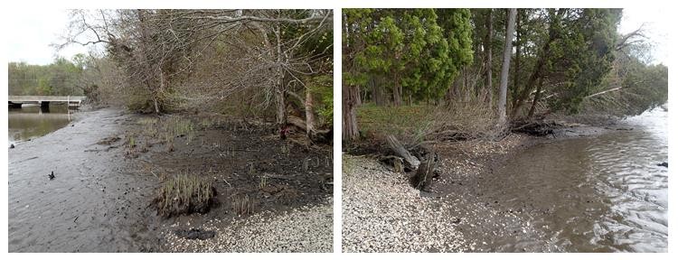
In the case of the Blackbird Creek Reserve living shoreline sites, the shoreline on either side of the kayak ramp was shifting and washing away due, in part, to quick moving river currents (Figure 2.). To prevent further erosion, or loss, of the shoreline and to protect the adjacent habitat, two living shorelines were installed in early May of 2015.

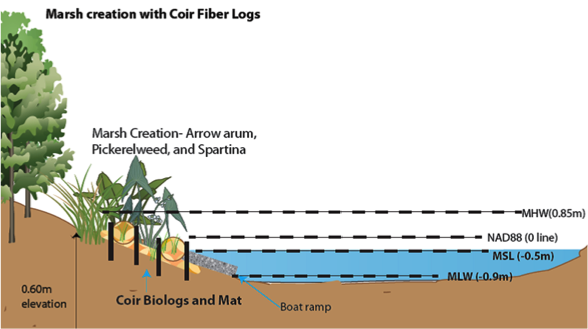
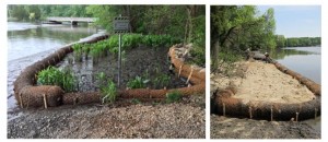
This project began by placing a series of coir logs, sand, dirt and wooden stakes along the bank to increase the height of the bank above the water level. These logs were placed on mats to stop them from sinking in the mud, and then staked in to keep them from moving. Coir logs act as temporary fences to hold soil in place and also trap sediments floating in the water column, giving plants a great habitat to grow. The West side location already had a native wetland plant, arrow arum, growing, but the east side location on the other side of the ramp was empty so clean sand was trucked in and topped with a little soil to create a nice high base (Figure 3.).

Once the mats, logs and sand were in place, a few weeks passed by to allow things to settle. In June of 2015, a variety of native plants (arrow arum, smooth cordgrass, pickerelweed, saltmarsh bulrush, yellow sneezeweed, swamp rose, marsh hibiscus, New York ironweed and pin oak) were planted in the projects. Once these plants start to grow, they will help further trap sediments, stabilize the bank and completely cover the coir log structures.
The site is regularly monitored to track progress, and is a collaboration between Delaware’s Natural Resources and Environmental Controls (DNREC) Wetland Monitoring and Assessment Program (WMAP), the Delaware National Estuarine Reserve (DNERR) and the Division of Fish and Wildlife.